Saint Mary's la Prairie Anglican Cemetery
Also known as St. Mary's Cemetery
Portage la Prairie, Portage la Prairie Census Division, Manitoba, Canada
About
-
- city-plap.maps.arcgis.com/apps/webappviewer/index.html?id=3b52d9d2b6854aada9da22afbc337080
- [email protected]
- +1-204-239-8346
-
Office Address
495 – 11th Street NW
Portage la Prairie, MB
R1N 4B3 Canada
c/o Parks Department - Cemeteries Division - Cemetery ID:
-
Additional information
Located on Norah Street just west of Hwy 240 and south of the Portage la Prairie Bypass, a part of Provincial Highway 1 (aka the Transcanada Highway); on the SW side, it is adjacent to the roadways that are part of the interchange between those two major area roads
Members have Contributed
Advertisement
Photos

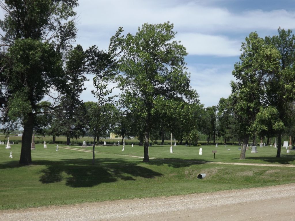
Established in 1855 on land that was designated at the time as being part of River Lot 107 in the area, St. Mary's Anglican Cemetery is one of the older cemeteries in the province. The first recorded burial is that of Henry Garrioch who was buried on October 3, 1855.
This cemetery has records gleaned from 3 sources:
1. Transcription from the stones
2. Information from drawings obtained from the City of Portage
3. Reading of the church registers at Anglican Centre in Winnipeg.
(N.B., These latter records date from the beginnings of the parish into the 1970s)
The burial records for the cemetery, which tell who was buried where were, apparently burned in a fire a few years ago which destroyed the church at this location which was never rebuilt.
The church registers contain many more names than are noted by stones or on the drawings. There is some confusion in the reading of the registers as some of the ministers noted where the burials took place and some did not. Also, the cemetery is referred to by several names.
Further: There are many flat stones which appear to have previously been vertical
Memorial Cairn: Erected to the glory of God and to mark the site of the first church erected west of St. John's, Winnipeg, built by Ven. Archdeacon Cochrane during the years 1853-54.
(Source: Manitoba Genealogical Society [Adapted])
In 1853, Bishop Anderson appointed the Rev. William Cochrane to establish a missionary station here, the first Anglican church west of St. James. Cochrane had previously relocated 25 families from the Red River Settlement to this area in 1851. The original church, known as St. Mary's La Prairie, was built between 1853 and 1855. It was the first Anglican church west of St. James.
This cemetery was part of the original grant of River Lot 107, deeded to the Rev. Henry George in 1870. In 1922, the cemetery was taken over by the City of Portage la Prairie and is presently administered by it.
(Source: Manitoba Historical Society [Adapted])
Dominion Land Survey coordinates: LSD02-30-36-28-W1
Operated as a City, Portage la Prairie is adjacent to and the administrative centre for the Rural Municipality of Portage La Prairie
A part of the story of the area and its inhabitants from the early days of European settlement through roughly 1932 is told in the volume "Tread of the Pioneers", especially starting on page 30. A free digital version of this and many other Manitoba local history books can be found online in the University of Manitoba Digital Collections. There is also a list of such books organized by district and town name on the Manitoba Historical Society's website on their page entitled "Finding Aid: Manitoba Local History Books".
A list of burials in this cemetery is available from the Manitoba Genealogical Society (reference #0321), as transcribed by a member or members in 1981 and updated in 2001. Also available to MGS members is a searchable online database named the MGS Manitoba Name Index (or MANI).
The cemetery is the responsibility of Parks / Cemeteries Division of the City of Portage la Prairie, whose website includes a very detailed map of the cemetery.
Additionally, many records for Anglican congregations in Manitoba and over part of the territory designated historically as "Rupert's Land" (esp, as bounded on the south by the U.S. border, extending north into the Manitoba Interlake Region past Fairford, with the western boundary reaching into the Pembina Hills and includes Portage la Prairie, eastward the diocese stretches to Sioux Lookout/Atikokan) are now with the Diocese of Rupert's Land and are kept in their offices in Winnipeg, Manitoba, Canada.
Nearby cemeteries

Portage la Prairie, Portage la Prairie Census Division, Manitoba, Canada
- Total memorials40
- Percent photographed78%
- Percent with GPS0%
Portage la Prairie Census Division, Manitoba, Canada
- Total memorials0
- Percent photographed0%

Portage la Prairie, Portage la Prairie Census Division, Manitoba, Canada
- Total memorials2k+
- Percent photographed40%
- Percent with GPS1%

Portage la Prairie, Portage la Prairie Census Division, Manitoba, Canada
- Total memorials10k+
- Percent photographed77%
- Percent with GPS5%
- Added: 18 Mar 2004
- Find a Grave Cemetery ID: 1980162

Cemetery Photos
This is a carousel with slides. Use Next and Previous buttons to navigate, or jump to a slide with the slide dots. Use Escape keyboard button or the Close button to close the carousel.

Success
Uploading...
Waiting...
Failed
This photo was not uploaded because this cemetery already has 20 photos
This photo was not uploaded because you have already uploaded 5 photos to this cemetery
This photo was not uploaded because you have already uploaded 5 photos to this cemetery
Invalid File Type
Birth and death years unknown.
1 photo picked...
2 photos picked...
Uploading 1 Photo
Uploading 2 Photos
1 Photo Uploaded
2 Photos Uploaded
Size exceeded
Too many photos have been uploaded
"Unsupported file type"
• ##count## of 0 memorials with GPS displayed. Double click on map to view more.No cemeteries found