Cope Cemetery
Jackson, Breathitt County, Kentucky, USA
About
-
- Cemetery ID:
Members have Contributed
Advertisement
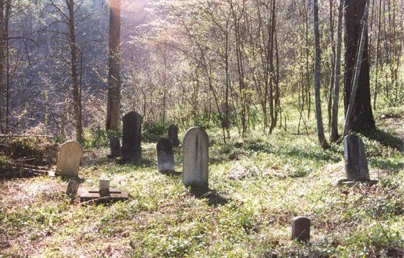
Photos


Turn left onto 1812 and take 1812 north approx. 5 or 6 miles to 540.
Turn right onto 540 (also known as Strong Fork Rd.) and go approx. 1.1 to 1.2 miles. The cemetery is on top of a big hill on the left (north) side of the road. On either side of the hill are homes, the first home you come to is where the owner of the cemetery lives (Mr. King). Also on either side of the hill, easily seen from the road, are other more recent graves.
Nearby cemeteries
Jackson, Breathitt County, Kentucky, USA
- Total memorials42
- Percent photographed7%
- Percent with GPS0%

Breathitt County, Kentucky, USA
- Total memorials56
- Percent photographed59%
- Percent with GPS2%
- Added: 6 Nov 2011
- Find a Grave Cemetery ID: 2425302

Cemetery Photos
This is a carousel with slides. Use Next and Previous buttons to navigate, or jump to a slide with the slide dots. Use Escape keyboard button or the Close button to close the carousel.


Success
Uploading...
Waiting...
Failed
This photo was not uploaded because this cemetery already has 20 photos
This photo was not uploaded because you have already uploaded 5 photos to this cemetery
This photo was not uploaded because you have already uploaded 5 photos to this cemetery
Invalid File Type
Birth and death years unknown.
1 photo picked...
2 photos picked...
Uploading 1 Photo
Uploading 2 Photos
1 Photo Uploaded
2 Photos Uploaded
Size exceeded
Too many photos have been uploaded
"Unsupported file type"
• ##count## of 0 memorials with GPS displayed. Double click on map to view more.No cemeteries found