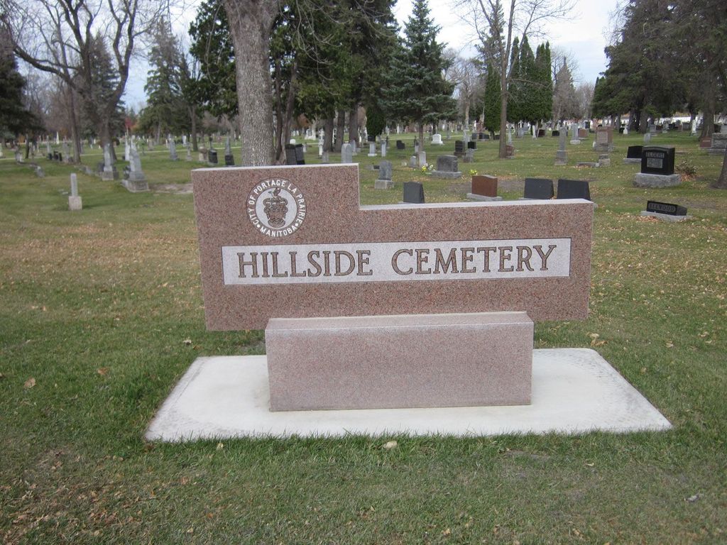
Hillside Cemetery
Also known as Hillside Memorial Park
Portage la Prairie, Portage la Prairie Census Division, Manitoba, Canada
About
-
- city-plap.maps.arcgis.com/apps/webappviewer/index.html?id=ab65eb33ce4d47d39a16d069315d645f
- [email protected]
- 1-204-239-8346
-
Office Address
495 – 11th Street NW
Portage la Prairie, Manitoba
R1N 4B3 Canada - Cemetery ID:
-
Additional information
Adjacent to and on the north side of the Transcanada Highway (TCH) Portage la Prairie Bypass (aka Provincial Highway 1), the cemetery has multiple entrances, with the main one from the city side being found on Cottonwood Drive. From the TCH, exit north into the city, turn left immediately onto the service road and watch on the north (right) side of the roadway for the first turn; that is Cemetery Road, and though it is unsigned at this intersection, one can already see the markers within the cemetery
Cemetery Road provides the principal vehicular access to the property, which has a network of roadways throughout which define the sections
Members have Contributed
Advertisement
Photos


Established in about 1874.
This cemetery is situated in the City of Portage la Prairie. Across from the cemetery (and indistinguishable from it on this service) is the Hillside Memorial Park which is focused on a plaque erected in memory of service personnel by the Royal Canadian Legion Branch #65 and the Army-Navy and Airforce Unit #13.
(Source: Manitoba Historical Society [Adapted])
Dominion Land Survey coordinates (for a point in the heart of the property): LSD03-03-12-07-W1
In the limits of the City of Portage la Prairie, which is also the administrative centre for the surrounding Rural Municipality of the same name
As can be seen on the online map, the cemetery is divided into several sections, some of which are designated as being for veterans and members of their families.
The name of this place derives from the early days of the fur trade in North America, likely given by the French explorers Radisson and Groseillers. It was a hub of trade to all points of the compass and the site of the military post known as "Fort de la Reine", first established by La Verendrye and his party.
As the location of a historic part of the settlement and development of this part of Manitoba and further afield into western Canada, the people of the place had lives that included many stories. These are told in various local history books, among them:
- First Furrows - A History of the Settlement of the Red River Colony, Including That of Portage la Prairie
- Our story of historic Portage La Prairie
- Portage la Prairie 1870-1970 - A History of Portage la Prairie and Surrounding District
- The Tread of the Pioneers
Free digital versions of these and many other Manitoba local history books can be found online in the University of Manitoba Digital Collections. There is also a list of such books organized by district and town name on the Manitoba Historical Society's website on their page entitled "Finding Aid: Manitoba Local History Books".
A list of burials in this cemetery is available from the Manitoba Genealogical Society (reference #1245), transcribed in conjunction with "The Prior Relations Genealogy Group" in 1994 - 1999 and redone in 2000. Also available to MGS members is a searchable online database named the "MGS Manitoba Name Index" (or MANI).
The City of Portage la Prairie Parks and Cemeteries Division is responsible for maintaining City-owned cemeteries (i.e., Hillside Cemetery, Hillside Memorial and St Mary's Cemetery). For more information regarding City-owned cemeteries, please contact the Operations Department.
Of note: Evergreen Memorial Gardens Cemetery is adjacent to this property and found on the north side of the 90-degree bend in Cottonwood Drive shared by the two cemeteries
Nearby cemeteries

Portage la Prairie, Portage la Prairie Census Division, Manitoba, Canada
- Total memorials2k+
- Percent photographed40%
- Percent with GPS1%

Portage la Prairie, Portage la Prairie Census Division, Manitoba, Canada
- Total memorials40
- Percent photographed78%
- Percent with GPS0%
Portage la Prairie Census Division, Manitoba, Canada
- Total memorials0
- Percent photographed0%

Portage la Prairie, Portage la Prairie Census Division, Manitoba, Canada
- Total memorials502
- Percent photographed74%
- Percent with GPS0%
- Added: 18 Mar 2003
- Find a Grave Cemetery ID: 1959933

Cemetery Photos
This is a carousel with slides. Use Next and Previous buttons to navigate, or jump to a slide with the slide dots. Use Escape keyboard button or the Close button to close the carousel.


Success
Uploading...
Waiting...
Failed
This photo was not uploaded because this cemetery already has 20 photos
This photo was not uploaded because you have already uploaded 5 photos to this cemetery
This photo was not uploaded because you have already uploaded 5 photos to this cemetery
Invalid File Type
Birth and death years unknown.
1 photo picked...
2 photos picked...
Uploading 1 Photo
Uploading 2 Photos
1 Photo Uploaded
2 Photos Uploaded
Size exceeded
Too many photos have been uploaded
"Unsupported file type"
• ##count## of 0 memorials with GPS displayed. Double click on map to view more.No cemeteries found