Whitla Cemetery
Whitla, Medicine Hat Census Division, Alberta, Canada
About
-
- Cemetery ID:
Members have Contributed
Advertisement
Photos


Community: Whitla
Township: NE 08-11-8 W4
Locality: Forty Mile
Province: AB
GPS: 49.895291,-111.051393
Driving Instructions:
Located approx. 2.6 kilometers north of Highway #3 (Crowsnest Trail) on Range Road #84
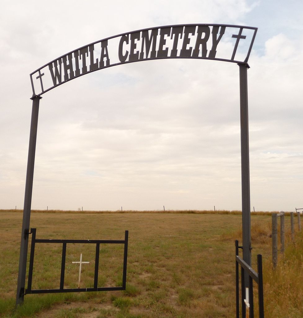
Owned by United Church of Canada. Eight of the graves have headstones and there are 7 white metal crosses without names. Until a plot plan is obtained, if one exists, photos these crosses cannot be added to the correct memorials.
Information from "TRIBUTE TO WHITLA PIONEERS" published in 1969 indicates there are non-cemetery burials in the Whitla area including:
- Mrs Herman Arndt and daughter are buried on NE 1/4 25-10-9-W4th.
- Baby, Irene Mildred Barnett is buried on either the Ludington or Barnett homestead.
- Byron E Poore is buried on Section 10-10-8-W4 along with 3 Pifer children - his grandchildren
- Delle E Smith is buried on NE 1/4 29-10-8 W4
- Baby, Malcolm Neil Lilja is buried on SW 1/4 16-12-8 W4
- 4 children of Mr & Mrs David Deering Sr are buried on their Homestead in Gross Venture District
To ensure these individuals are remembered there are memorials noting they are isolated graves with the location, if known.
+++++++++++++++++++++++++++++++++
August 14 2014 - From Wikipedia
Whitla is an unincorporated community in Alberta, Canada within the County of Forty Mile No. 8. Located 20 miles south west of the city of Medicine Hat and one mile north of Highway 3.
History
Like most towns in the surrounding region, Whitla's beginnings started with the opening of homestead land in 1908, but there had been some activity before that. Named after R.J. Whitla, a Winnipeg merchant, who visited the site while it was a mere siding in 1885, squatters and cattle ranchers had taken up land in the vicinity as early as 1884. At that time, Medicine Hat was the trading center, but with the construction of the Turkey Track railway, a sensible community grew up around the village of Seven Persons.
Hundreds of settlers from North Dakota poured into the district in 1909, Lured by blatantly false promises from real estate agents, government officials and advertising brochures. They brought their customs with them; they celebrated the Fourth of July, rather than the First; They introduced oxen into the short-grass area.
The first merchant to settle at Whitla was Sam Richardson, who moved there in 1909. Before him, the town had consisted merely of a siding, a section house and the inevitable dugout for the track workers. Richardson built a store with lumbar shipped in from Medicine Hat, and behind it a one-roomed shack for his family.
That following year, Alex and Chris Ashton opened another general store - this time on the north side of the tracks - and their firm was quickly followed by a hardware, a lumbar yard and a farm machinery firm. Though the Aston store burned in January, 1916, the town continued to grow rapidly, with a Union Bank, two cafes, a billiard hall and three garages.
The settlers and residents of Whitla rared no better or worse than their neighbors at Winnifred. By 1924, the Alberta Government had a standing offer to relocate any homesteader who wished to leave. Many accepted the assistance. In 1927-28 (twelve years after the first bumper crops) there were two magnificent harvests and Whitla boomed. However, for the next twelve years there was only misery.
The Dirty Thirties Brought dry years, crop failures, grasshoppers hordes of voracious rabbits and dust storms. In Tribute to Whitla Pioneers, Carl Larson recalls a dust storm so sever that people could see grasshoppers digging holes four feet above ground.
A gradual exodus beginning as early as 1920, it was sped up during the 1930s and early 40s. By the end of World War II, the small homesteads had virtually vanished, giving way to huge farms and ranches. The paving and relocation of Highway 3 in 1949, as in other areas where modern highways bypass towns, was the final blow to the economy of the village.
The mid-1950s brought promise of improvement, first with the introduction of electricity in 1955 and the beginning of irrigation from the St. Mary River Project in the following year.
The local dam, located north of Whitla, was appropriately named Rattlesnake Dam. Unfortunately, irrigation had arrived 40 years too late.
The 1960s saw the gradual disintegration of Whitla and the closing of the school in 1964 was the last signal of defeat. For a short time after the towns grain elevators remained in operation until their destruction in the mid 1990s.
Community: Whitla
Township: NE 08-11-8 W4
Locality: Forty Mile
Province: AB
GPS: 49.895291,-111.051393
Driving Instructions:
Located approx. 2.6 kilometers north of Highway #3 (Crowsnest Trail) on Range Road #84
Owned by United Church of Canada. Eight of the graves have headstones and there are 7 white metal crosses without names. Until a plot plan is obtained, if one exists, photos these crosses cannot be added to the correct memorials.
Information from "TRIBUTE TO WHITLA PIONEERS" published in 1969 indicates there are non-cemetery burials in the Whitla area including:
- Mrs Herman Arndt and daughter are buried on NE 1/4 25-10-9-W4th.
- Baby, Irene Mildred Barnett is buried on either the Ludington or Barnett homestead.
- Byron E Poore is buried on Section 10-10-8-W4 along with 3 Pifer children - his grandchildren
- Delle E Smith is buried on NE 1/4 29-10-8 W4
- Baby, Malcolm Neil Lilja is buried on SW 1/4 16-12-8 W4
- 4 children of Mr & Mrs David Deering Sr are buried on their Homestead in Gross Venture District
To ensure these individuals are remembered there are memorials noting they are isolated graves with the location, if known.
+++++++++++++++++++++++++++++++++
August 14 2014 - From Wikipedia
Whitla is an unincorporated community in Alberta, Canada within the County of Forty Mile No. 8. Located 20 miles south west of the city of Medicine Hat and one mile north of Highway 3.
History
Like most towns in the surrounding region, Whitla's beginnings started with the opening of homestead land in 1908, but there had been some activity before that. Named after R.J. Whitla, a Winnipeg merchant, who visited the site while it was a mere siding in 1885, squatters and cattle ranchers had taken up land in the vicinity as early as 1884. At that time, Medicine Hat was the trading center, but with the construction of the Turkey Track railway, a sensible community grew up around the village of Seven Persons.
Hundreds of settlers from North Dakota poured into the district in 1909, Lured by blatantly false promises from real estate agents, government officials and advertising brochures. They brought their customs with them; they celebrated the Fourth of July, rather than the First; They introduced oxen into the short-grass area.
The first merchant to settle at Whitla was Sam Richardson, who moved there in 1909. Before him, the town had consisted merely of a siding, a section house and the inevitable dugout for the track workers. Richardson built a store with lumbar shipped in from Medicine Hat, and behind it a one-roomed shack for his family.
That following year, Alex and Chris Ashton opened another general store - this time on the north side of the tracks - and their firm was quickly followed by a hardware, a lumbar yard and a farm machinery firm. Though the Aston store burned in January, 1916, the town continued to grow rapidly, with a Union Bank, two cafes, a billiard hall and three garages.
The settlers and residents of Whitla rared no better or worse than their neighbors at Winnifred. By 1924, the Alberta Government had a standing offer to relocate any homesteader who wished to leave. Many accepted the assistance. In 1927-28 (twelve years after the first bumper crops) there were two magnificent harvests and Whitla boomed. However, for the next twelve years there was only misery.
The Dirty Thirties Brought dry years, crop failures, grasshoppers hordes of voracious rabbits and dust storms. In Tribute to Whitla Pioneers, Carl Larson recalls a dust storm so sever that people could see grasshoppers digging holes four feet above ground.
A gradual exodus beginning as early as 1920, it was sped up during the 1930s and early 40s. By the end of World War II, the small homesteads had virtually vanished, giving way to huge farms and ranches. The paving and relocation of Highway 3 in 1949, as in other areas where modern highways bypass towns, was the final blow to the economy of the village.
The mid-1950s brought promise of improvement, first with the introduction of electricity in 1955 and the beginning of irrigation from the St. Mary River Project in the following year.
The local dam, located north of Whitla, was appropriately named Rattlesnake Dam. Unfortunately, irrigation had arrived 40 years too late.
The 1960s saw the gradual disintegration of Whitla and the closing of the school in 1964 was the last signal of defeat. For a short time after the towns grain elevators remained in operation until their destruction in the mid 1990s.
Nearby cemeteries

Whitla, Medicine Hat Census Division, Alberta, Canada
- Total memorials19
- Percent photographed100%
- Percent with GPS0%

Seven Persons, Medicine Hat Census Division, Alberta, Canada
- Total memorials13
- Percent photographed46%

Seven Persons, Medicine Hat Census Division, Alberta, Canada
- Total memorials7
- Percent photographed100%

Winnifred, Medicine Hat Census Division, Alberta, Canada
- Total memorials147
- Percent photographed69%
- Percent with GPS1%
- Added: 28 Jul 2014
- Find a Grave Cemetery ID: 2548666

Cemetery Photos
This is a carousel with slides. Use Next and Previous buttons to navigate, or jump to a slide with the slide dots. Use Escape keyboard button or the Close button to close the carousel.


Success
Uploading...
Waiting...
Failed
This photo was not uploaded because this cemetery already has 20 photos
This photo was not uploaded because you have already uploaded 5 photos to this cemetery
This photo was not uploaded because you have already uploaded 5 photos to this cemetery
Invalid File Type
Birth and death years unknown.
1 photo picked...
2 photos picked...
Uploading 1 Photo
Uploading 2 Photos
1 Photo Uploaded
2 Photos Uploaded
Size exceeded
Too many photos have been uploaded
"Unsupported file type"
• ##count## of 0 memorials with GPS displayed. Double click on map to view more.No cemeteries found