Westouter Churchyard and Extension
Westouter, Arrondissement Ieper, West Flanders, Belgium

Location Information: Westouter Churchyard and Extension is located 12 Km south west of Ieper town centre, on a road leading from the N375 Dikkebusseweg. From Ieper town centre the Dikkebusseweg (N375) is located via Elverdingsestraat, straight over a roundabout onto J.Capronstraat (for 30 metres), then left along M.Fochlaan. Immediately after the train station, the first right hand turning is the Dikkebusseweg. 10 Km along the Dikkebusseweg after passing through the villages of Dikkebus and De Klijte, lies the right hand turning onto the N315 Sulferbergstraat. 2.5 Km along the N315 lies the village of Westouter. The churchyard is located in the centre of the village and the Commission plot is located on the far right hand side of the cemetery after entering the site.
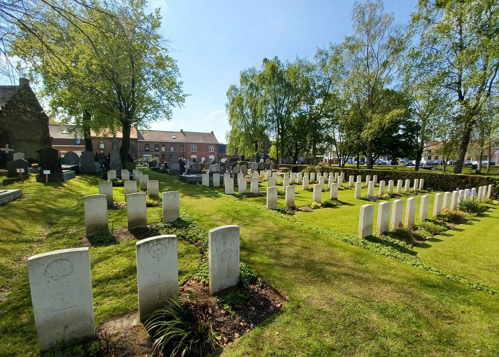
Historical Information: The village of Westoutre (now Westouter) remained in Allied hands from the early months of the First World War to the Armistice, but in the summer of 1918, after the Battles of the Lys, it was within 2.4 kilometres of the front line. The churchyard and extension was used by field ambulances and fighting units at intervals from November 1914 to September 1918. It contains 98 Commonwealth burials of the First World War and three German graves.
No. of Identified Casualties: 100
Location Information: Westouter Churchyard and Extension is located 12 Km south west of Ieper town centre, on a road leading from the N375 Dikkebusseweg. From Ieper town centre the Dikkebusseweg (N375) is located via Elverdingsestraat, straight over a roundabout onto J.Capronstraat (for 30 metres), then left along M.Fochlaan. Immediately after the train station, the first right hand turning is the Dikkebusseweg. 10 Km along the Dikkebusseweg after passing through the villages of Dikkebus and De Klijte, lies the right hand turning onto the N315 Sulferbergstraat. 2.5 Km along the N315 lies the village of Westouter. The churchyard is located in the centre of the village and the Commission plot is located on the far right hand side of the cemetery after entering the site.
Historical Information: The village of Westoutre (now Westouter) remained in Allied hands from the early months of the First World War to the Armistice, but in the summer of 1918, after the Battles of the Lys, it was within 2.4 kilometres of the front line. The churchyard and extension was used by field ambulances and fighting units at intervals from November 1914 to September 1918. It contains 98 Commonwealth burials of the First World War and three German graves.
No. of Identified Casualties: 100
Nearby cemeteries

Westouter, Arrondissement Ieper, West Flanders, Belgium
- Total memorials145
- Percent photographed100%
- Percent with GPS1%

Reningelst, Arrondissement Ieper, West Flanders, Belgium
- Total memorials798
- Percent photographed31%
- Percent with GPS5%

Saint-Jans-Cappel, Departement du Nord, Nord-Pas-de-Calais, France
- Total memorials137
- Percent photographed27%
- Percent with GPS4%

Loker, Arrondissement Ieper, West Flanders, Belgium
- Total memorials216
- Percent photographed99%
- Percent with GPS2%
- Added: 16 Apr 2006
- Find a Grave Cemetery ID: 2173539

Cemetery Photos
This is a carousel with slides. Use Next and Previous buttons to navigate, or jump to a slide with the slide dots. Use Escape keyboard button or the Close button to close the carousel.

Success
Uploading...
Waiting...
Failed
This photo was not uploaded because this cemetery already has 20 photos
This photo was not uploaded because you have already uploaded 5 photos to this cemetery
This photo was not uploaded because you have already uploaded 5 photos to this cemetery
Invalid File Type
Birth and death years unknown.
1 photo picked...
2 photos picked...
Uploading 1 Photo
Uploading 2 Photos
1 Photo Uploaded
2 Photos Uploaded
Size exceeded
Too many photos have been uploaded
"Unsupported file type"
• ##count## of 0 memorials with GPS displayed. Double click on map to view more.No cemeteries found