Track X Cemetery
Ypres, Arrondissement Ieper, West Flanders, Belgium
About
-
- Cemetery ID:
Members have Contributed
Advertisement
Photos

Location Information: The cemetery is located to the North East of the town of Ieper. From the station turn left and drive along M.Fochlaan to the roundabout, turn right and go to the next roundabout. Here turn left into M.Haiglaan and drive to the next roundabout. Here turn right into Oude Veurnestraat, this then changes into Diksmuidseweg and Brugseweg. Drive along this road and continue straight over the traffic lights to the end of the road. At the T junction turn left (still Brugseweg) and continue along this road through the village of Saint Jan (N313). Follow this road to the end. You come to the junction with the N38, straight across this junction into Hogeziekenweg. After 50 metres the road bends sharply to the left, follow the road to the crossroads, then turn right into the Moortelweg. The cemetery is approximately 150 metres down this road on the right hand side.
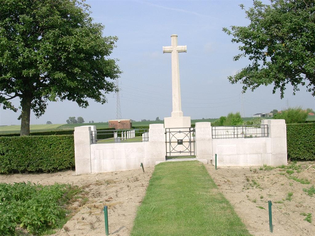
Historical Information: The site of the cemetery was between the Allied and German front lines in June 1917. The cemetery was begun by the 39th and 48th (South Midland) Divisions at the end of July, after Commonwealth forces advanced on this front. It was closed in November 1917, except for two burials in May 1918. There are now 149 First World War burials in the cemetery, 27 of them unidentified.
No. of Identified Casualties: 122
Location Information: The cemetery is located to the North East of the town of Ieper. From the station turn left and drive along M.Fochlaan to the roundabout, turn right and go to the next roundabout. Here turn left into M.Haiglaan and drive to the next roundabout. Here turn right into Oude Veurnestraat, this then changes into Diksmuidseweg and Brugseweg. Drive along this road and continue straight over the traffic lights to the end of the road. At the T junction turn left (still Brugseweg) and continue along this road through the village of Saint Jan (N313). Follow this road to the end. You come to the junction with the N38, straight across this junction into Hogeziekenweg. After 50 metres the road bends sharply to the left, follow the road to the crossroads, then turn right into the Moortelweg. The cemetery is approximately 150 metres down this road on the right hand side.
Historical Information: The site of the cemetery was between the Allied and German front lines in June 1917. The cemetery was begun by the 39th and 48th (South Midland) Divisions at the end of July, after Commonwealth forces advanced on this front. It was closed in November 1917, except for two burials in May 1918. There are now 149 First World War burials in the cemetery, 27 of them unidentified.
No. of Identified Casualties: 122
Nearby cemeteries

Ypres, Arrondissement Ieper, West Flanders, Belgium
- Total memorials203
- Percent photographed100%
- Percent with GPS6%

Ypres, Arrondissement Ieper, West Flanders, Belgium
- Total memorials109
- Percent photographed100%
- Percent with GPS0%

Langemark-Poelkapelle, Arrondissement Ieper, West Flanders, Belgium
- Total memorials128
- Percent photographed99%
- Percent with GPS2%

Ypres, Arrondissement Ieper, West Flanders, Belgium
- Total memorials560
- Percent photographed100%
- Percent with GPS1%
- Added: 20 Oct 2005
- Find a Grave Cemetery ID: 2156028

Cemetery Photos
This is a carousel with slides. Use Next and Previous buttons to navigate, or jump to a slide with the slide dots. Use Escape keyboard button or the Close button to close the carousel.

Success
Uploading...
Waiting...
Failed
This photo was not uploaded because this cemetery already has 20 photos
This photo was not uploaded because you have already uploaded 5 photos to this cemetery
This photo was not uploaded because you have already uploaded 5 photos to this cemetery
Invalid File Type
Birth and death years unknown.
1 photo picked...
2 photos picked...
Uploading 1 Photo
Uploading 2 Photos
1 Photo Uploaded
2 Photos Uploaded
Size exceeded
Too many photos have been uploaded
"Unsupported file type"
• ##count## of 0 memorials with GPS displayed. Double click on map to view more.No cemeteries found