St. Mary's Churchyard
Standon, East Hertfordshire District, Hertfordshire, England
About
-
Get directions High Street
Standon, East Hertfordshire District, Hertfordshire SG11 1 LB EnglandCoordinates: 51.88135, 0.02738 - Cemetery ID:
Members have Contributed
Advertisement
Photos


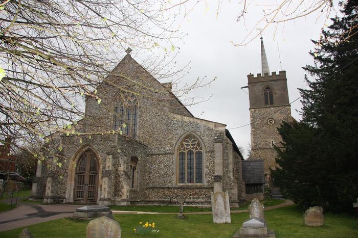
The church, a Grade I listed building, stands at the end of the High Street. Although originating as a Saxon church, it was built largely in the 13th and 14th centuries, having been bequeathed in the 12th century to the Knights of St John, who built most of the Church as it is seen today, though there was some Victorian restoration.
The church, a Grade I listed building, stands at the end of the High Street. Although originating as a Saxon church, it was built largely in the 13th and 14th centuries, having been bequeathed in the 12th century to the Knights of St John, who built most of the Church as it is seen today, though there was some Victorian restoration.
Nearby cemeteries

Northchurch, Dacorum Borough, Hertfordshire, England
- Total memorials6
- Percent photographed100%
- Percent with GPS0%

Old Hall Green, East Hertfordshire District, Hertfordshire, England
- Total memorials24
- Percent photographed67%
- Percent with GPS0%

Braughing, East Hertfordshire District, Hertfordshire, England
- Total memorials92
- Percent photographed70%
- Percent with GPS14%

Much Hadham, East Hertfordshire District, Hertfordshire, England
- Total memorials47
- Percent photographed72%
- Percent with GPS2%
- Added: 1 Jan 2006
- Find a Grave Cemetery ID: 2162299

Cemetery Photos
This is a carousel with slides. Use Next and Previous buttons to navigate, or jump to a slide with the slide dots. Use Escape keyboard button or the Close button to close the carousel.


Success
Uploading...
Waiting...
Failed
This photo was not uploaded because this cemetery already has 20 photos
This photo was not uploaded because you have already uploaded 5 photos to this cemetery
This photo was not uploaded because you have already uploaded 5 photos to this cemetery
Invalid File Type
Birth and death years unknown.
1 photo picked...
2 photos picked...
Uploading 1 Photo
Uploading 2 Photos
1 Photo Uploaded
2 Photos Uploaded
Size exceeded
Too many photos have been uploaded
"Unsupported file type"
• ##count## of 0 memorials with GPS displayed. Double click on map to view more.No cemeteries found