Lyleton Cemetery
Lyleton, Southwestern Census Division, Manitoba, Canada
About
-
- www.mhs.mb.ca/docs/sites/lyletoncemetery.shtml
- Cemetery ID:
Members have Contributed
Advertisement
Photos
No additional photos.
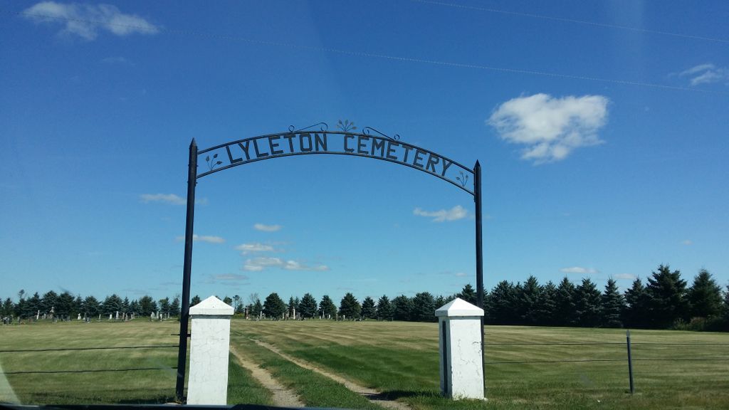
Add PhotosDominion Land Survey coordinates: LSD2-15-01-28-W1
In the Rural Municipality of Two Borders
Located SW of the town site of Lyleton, MB, on the north side of Provincial Range Road 2N, midway between Provincial Roads 164W and 165W
As already noted above, a part of the story of the town and its inhabitants from the early days of European settlement in the late 1880s through roughly 2011 is told in the volume "Harvests of Time - The Sequel", especially starting on page 6 and page 59.
A digital version of this book, the first one produced for the same area, and many other Manitoba local history books can be found online in the University of Manitoba Digital Collections.
Dominion Land Survey coordinates: LSD2-15-01-28-W1
In the Rural Municipality of Two Borders
Located SW of the town site of Lyleton, MB, on the north side of Provincial Range Road 2N, midway between Provincial Roads 164W and 165W
As already noted above, a part of the story of the town and its inhabitants from the early days of European settlement in the late 1880s through roughly 2011 is told in the volume "Harvests of Time - The Sequel", especially starting on page 6 and page 59.
A digital version of this book, the first one produced for the same area, and many other Manitoba local history books can be found online in the University of Manitoba Digital Collections.
Nearby cemeteries

Pierson, Southwestern Census Division, Manitoba, Canada
- Total memorials4
- Percent photographed100%
- Percent with GPS50%

Antler, Bottineau County, North Dakota, USA
- Total memorials4
- Percent photographed100%
- Percent with GPS0%

Coulter, Southwestern Census Division, Manitoba, Canada
- Total memorials69
- Percent photographed48%
- Percent with GPS0%

Antler, Bottineau County, North Dakota, USA
- Total memorials262
- Percent photographed89%
- Percent with GPS0%
- Added: 8 Nov 2010
- Find a Grave Cemetery ID: 2376944

Cemetery Photos
This is a carousel with slides. Use Next and Previous buttons to navigate, or jump to a slide with the slide dots. Use Escape keyboard button or the Close button to close the carousel.
Success
Uploading...
Waiting...
Failed
This photo was not uploaded because this cemetery already has 20 photos
This photo was not uploaded because you have already uploaded 5 photos to this cemetery
This photo was not uploaded because you have already uploaded 5 photos to this cemetery
Invalid File Type
Birth and death years unknown.
1 photo picked...
2 photos picked...
Uploading 1 Photo
Uploading 2 Photos
1 Photo Uploaded
2 Photos Uploaded
Size exceeded
Too many photos have been uploaded
"Unsupported file type"
• ##count## of 0 memorials with GPS displayed. Double click on map to view more.No cemeteries found