Pollard Cemetery
Pollard, Escambia County, Alabama, USA
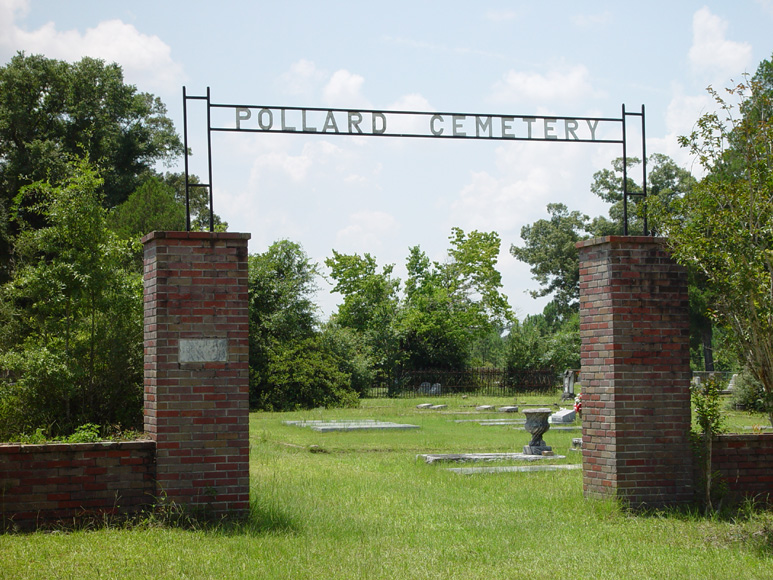
The Pollard cemetery is divided into two sections that were referred to in olden times as the White Section and the Black Section. The Black Section was originally set aside as a place to bury slaves. That is no longer the case, however, but it is important to note that there are two distinct burial locations. These are now commonly called the Pollard Cemetery and the Pollard Cemetery South Field. Looking at the map below, the Pollard Cemetery is that portion that lies inside the circular unpaved roadway. The South Field is all the meadowland that is enclosed behind a chain-link fence.
To locate the Pollard Cemetery when traveling south on the 4-lane H-31 from Brewton, turn left at the old Hwy-31 (also called Pollard/McCall Road at the historical marker on the north-bound side). Travel south on this road for about 1.5 miles to Wolf Log Road. Turn right and drive another quarter mile. The Hillcrest Cemetery will be on the left. At about 100 yards beyond Hillcrest will be a small sign on the left pointing to Pollard Cemetery. This is a hard clay road and the cemetery gates can be seen for some distance. The unpaved road makes a large circular drive around the area known as Pollard Cemetery (formerly referred to as the Pollard Cemetery White Section).
If traveling north on the 4-lane Hwy-31 from Flomaton, after crossing the double bridges, drive about 1.5 miles to the historical marker on the right. This is the old Hwy-31 (Pollard/McCall Road). Turn right and drive another 1.5 miles to Wolf Log Road. And turn right again. Follow the instructions as noted above.
At the rear and left side of the road is a large open meadow that will have scattered grave markers, and some will be in large family clusters. That is the area originally referred to as the Pollard Cemetery Black Section. The chain-link fence completely encloses the meadow and there is an east and a west entrance. There are no padlocks and one can walk freely among the old and new burial sites. There will be two service roads that cross the meadow, so it is important when driving through the cemetery one keeps to the service road as the burial sites are randomly placed.
Text by D. Searcy, Escambia County Historical Society, 2/6/11)
Nearby cemeteries

Pollard, Escambia County, Alabama, USA
- Total memorials165
- Percent photographed90%
- Percent with GPS26%

Flomaton, Escambia County, Alabama, USA
- Total memorials93
- Percent photographed97%
- Percent with GPS2%

Flomaton, Escambia County, Alabama, USA
- Total memorials171
- Percent photographed94%
- Percent with GPS3%
- Added: 1 Jan 2000
- Find a Grave Cemetery ID: 25586

Cemetery Photos
This is a carousel with slides. Use Next and Previous buttons to navigate, or jump to a slide with the slide dots. Use Escape keyboard button or the Close button to close the carousel.
Success
Uploading...
Waiting...
Failed
This photo was not uploaded because this cemetery already has 20 photos
This photo was not uploaded because you have already uploaded 5 photos to this cemetery
This photo was not uploaded because you have already uploaded 5 photos to this cemetery
Invalid File Type
Birth and death years unknown.
1 photo picked...
2 photos picked...
Uploading 1 Photo
Uploading 2 Photos
1 Photo Uploaded
2 Photos Uploaded
Size exceeded
Too many photos have been uploaded
"Unsupported file type"
• ##count## of 0 memorials with GPS displayed. Double click on map to view more.No cemeteries found