Mowrey Cemetery
Clay Township, Decatur County, Indiana, USA
About
-
Get directions W Base Road
Clay Township, Indiana 47240 United StatesCoordinates: 39.33280, -85.57920 - Cemetery ID:
Members have Contributed
Advertisement
Photos


by Nelson Mowrey, who erected a wall around the graveyard. The researchers
also estimated that there were 20-25 unmarked graves there. (ref: Mowrey
Cemetery burial list at Decatur County IN library)
The cemetery is located in Clay Township (SW quadrant of the NE quadrant of the NE quadrant of Section 12 Township 10N Range 8E) about 950 feet south of W Base Road about 0.3 miles west of its intersection with N County Road 500 W.
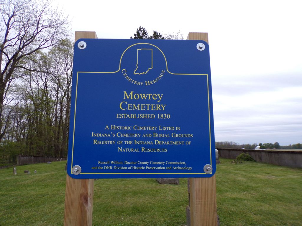
Indiana Cemetery Locations, Volume 3, published by the Indiana Genealogical Society (April 2007), gives the primary cemetery name as Mowrey Cemetery.
The cemetery is listed in the Cemetery and Burial Grounds Registry of the Indiana Department of Natural Resources (DNR) and in the State Historical Architectural and Archaeological Research Database (SHAARD) with Cemetery Record Number CR-16-23 (Mowrey).
The Indiana Historic Sites and Structures Inventory (IHSSI) survey number for Mowrey Cemetery is 031-211-15033 with the dataset compiled in 1999.
The U.S. Geological Survey (USGS) Geographic Names Information System (GNIS) feature ID for the cemetery is 439787 (Mowrey Cemetery).
by Nelson Mowrey, who erected a wall around the graveyard. The researchers
also estimated that there were 20-25 unmarked graves there. (ref: Mowrey
Cemetery burial list at Decatur County IN library)
The cemetery is located in Clay Township (SW quadrant of the NE quadrant of the NE quadrant of Section 12 Township 10N Range 8E) about 950 feet south of W Base Road about 0.3 miles west of its intersection with N County Road 500 W.
Indiana Cemetery Locations, Volume 3, published by the Indiana Genealogical Society (April 2007), gives the primary cemetery name as Mowrey Cemetery.
The cemetery is listed in the Cemetery and Burial Grounds Registry of the Indiana Department of Natural Resources (DNR) and in the State Historical Architectural and Archaeological Research Database (SHAARD) with Cemetery Record Number CR-16-23 (Mowrey).
The Indiana Historic Sites and Structures Inventory (IHSSI) survey number for Mowrey Cemetery is 031-211-15033 with the dataset compiled in 1999.
The U.S. Geological Survey (USGS) Geographic Names Information System (GNIS) feature ID for the cemetery is 439787 (Mowrey Cemetery).
Nearby cemeteries
Burney, Decatur County, Indiana, USA
- Total memorials3
- Percent photographed0%
- Percent with GPS0%
Clay Township, Decatur County, Indiana, USA
- Total memorials2
- Percent photographed0%

Milford, Decatur County, Indiana, USA
- Total memorials1k+
- Percent photographed80%
- Percent with GPS2%
Clay Township, Decatur County, Indiana, USA
- Total memorials0
- Percent photographed0%
- Percent with GPS0%
- Added: 1 Jan 2000
- Find a Grave Cemetery ID: 86087

Cemetery Photos
This is a carousel with slides. Use Next and Previous buttons to navigate, or jump to a slide with the slide dots. Use Escape keyboard button or the Close button to close the carousel.


Success
Uploading...
Waiting...
Failed
This photo was not uploaded because this cemetery already has 20 photos
This photo was not uploaded because you have already uploaded 5 photos to this cemetery
This photo was not uploaded because you have already uploaded 5 photos to this cemetery
Invalid File Type
Birth and death years unknown.
1 photo picked...
2 photos picked...
Uploading 1 Photo
Uploading 2 Photos
1 Photo Uploaded
2 Photos Uploaded
Size exceeded
Too many photos have been uploaded
"Unsupported file type"
• ##count## of 0 memorials with GPS displayed. Double click on map to view more.No cemeteries found