Togus National Cemetery
Chelsea, Kennebec County, Maine, USA
About
-
Get directions VA Medical and Regional Office Center
Chelsea, Maine 04330 United StatesCoordinates: 44.27640, -69.71164 - (508) 563-7113
- Cemetery ID:
Members have Contributed
Advertisement
Photos


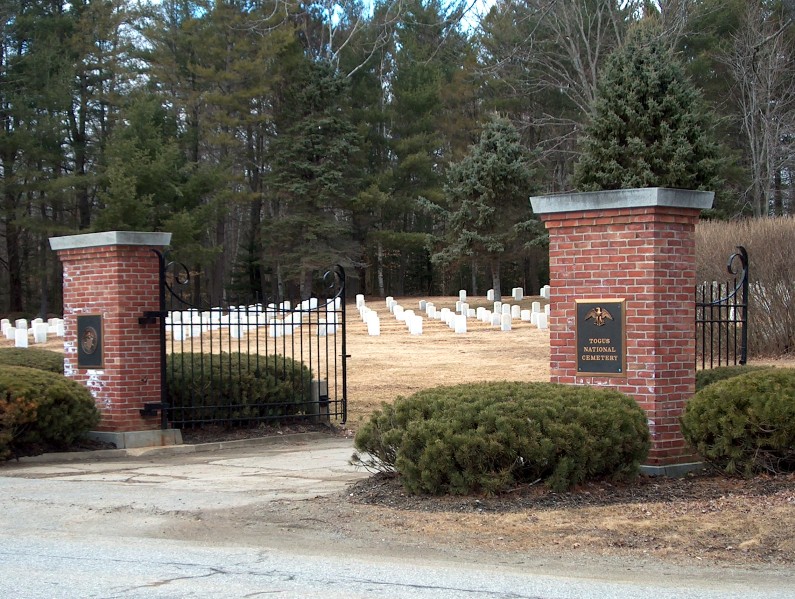
Togus National Cemetery is located in Kennebec County, in the town of Chelsea, Maine, on the grounds of the Department of Veterans Affairs Medical and Regional Office Center.
The name Togus comes from the Native American name Worromontogus, which means mineral water. The Togus property was originally a summer resort called Togus Springs. It was owned and operated by Horace Beals, a wealthy granite merchant from Rockland, Maine, who hoped to establish a racing and resort community like Saratoga Springs, N.Y. He invested over $250,000 in a hotel, stables, bowling alley, farmhouse, bathhouse, driveways and racetrack. The untimely resort opened in 1859 but failed to generate business due to the Civil War. The resort, known locally as "Beals' Folly," closed in 1863. Beals died shortly after his business failed and the government obtained the property for $50,000. The spot was selected because of its isolation from large cities, well-known spring and bargain price tag.
In 1865, as the Civil War was drawing to a close, President Abraham Lincoln signed an act establishing the National Asylum (later changed to Home) for Disabled Volunteer Soldiers. The Eastern Branch at Togus was the first of these facilities to open, in November 1866.
The first veteran was admitted to Togus on Nov. 10, 1866. The home's population remained below 400 until a building program began in 1868, which eventually provided accommodation for nearly 3,000 veterans. The facilities were organized much like a military camp with men living in barracks and wearing modified Army uniforms. Although a 100-bed hospital was completed in 1870, medical care at the home was limited, even by the standards of the day.
Togus was a relatively isolated location until 1890, when a narrow-gauge railroad from the Kennebec River in Randolph and an electric trolley line from Augusta were completed. These transportation improvements led to the home becoming a popular excursion destination for Sunday picnics. The grounds featured a zoo, hotel and theater that brought shows directly from Broadway. Band concerts were also held there regularly. The facility became part of the Veterans Administration (VA) in July 1930 when all agencies administering benefits to veterans were consolidated.
Togus National Cemetery is divided into a West Cemetery and an East Cemetery, with a total of 31 acres. The older West Cemetery was established in 1865 and moved to its present location west of the home about 1867; it closed for interments in 1936. To continue providing burial space, the East Cemetery was established in 1936 and closed for interments in 1961.
West Cemetery (older) is located near 723 Hallowell Road; see map above.
East Cemetery (newer) is located on Foggy Bottom Trail. GPS coordinates are 44.27670, -69.69710.
Nearby cemeteries
Chelsea, Kennebec County, Maine, USA
- Total memorials31
- Percent photographed71%
- Percent with GPS0%

Chelsea, Kennebec County, Maine, USA
- Total memorials144
- Percent photographed98%
- Percent with GPS3%

Chelsea, Kennebec County, Maine, USA
- Total memorials69
- Percent photographed96%
- Percent with GPS3%
- Added: 1 Jan 2000
- Find a Grave Cemetery ID: 109447

Cemetery Photos
This is a carousel with slides. Use Next and Previous buttons to navigate, or jump to a slide with the slide dots. Use Escape keyboard button or the Close button to close the carousel.


Success
Uploading...
Waiting...
Failed
This photo was not uploaded because this cemetery already has 20 photos
This photo was not uploaded because you have already uploaded 5 photos to this cemetery
This photo was not uploaded because you have already uploaded 5 photos to this cemetery
Invalid File Type
Birth and death years unknown.
1 photo picked...
2 photos picked...
Uploading 1 Photo
Uploading 2 Photos
1 Photo Uploaded
2 Photos Uploaded
Size exceeded
Too many photos have been uploaded
"Unsupported file type"
• ##count## of 0 memorials with GPS displayed. Double click on map to view more.No cemeteries found