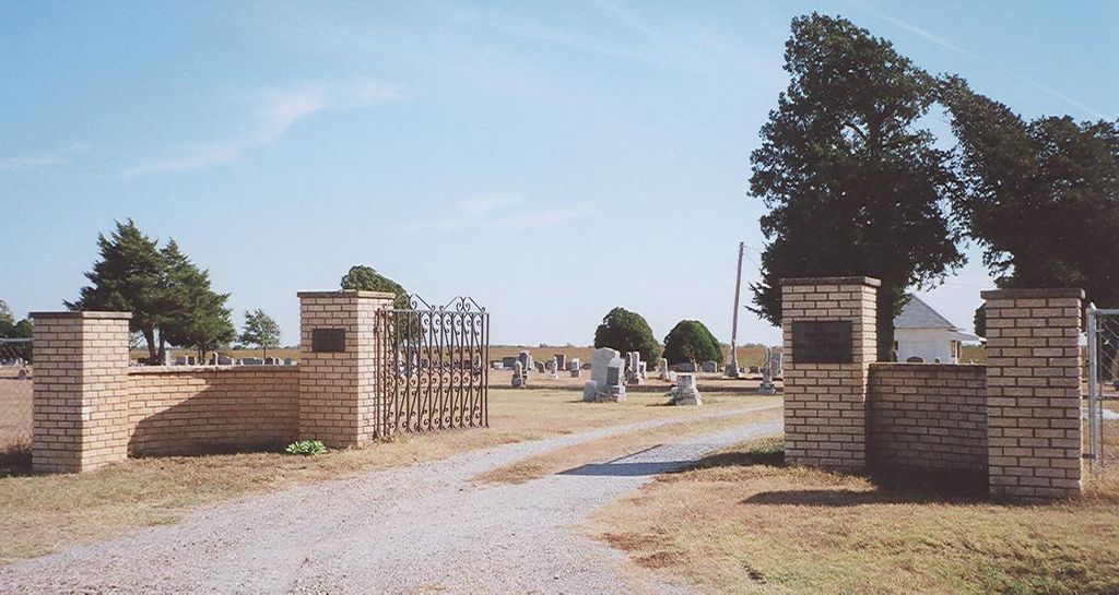
Rose Hill Cemetery
South Haven, Sumner County, Kansas, USA
About
-
- Cemetery ID:
Members have Contributed
Advertisement
Photos


The original plat measured 227' x 574'. Through the years more area was added four or five more times so that according to a deed recorded in 1959, it measured 404' x 1775', which is approximately 20 acres.
James W. Hamilton received a School Patent (Kansas law names sections 16 and 36 as sections in which schools are to be built) from John P. St. John, Governor of Kansas, dated March 24, 1879, and recorded in Book 8, Page 437 of Deed Records.
James W. Hamilton got a mortgage on Section 36 and excepts 2 acres off of the Southwest Corner of Southwest Quarter, and was dated February 1, 1879. (Note: Does not say what this 2 acres is used for.)
On March 4, 1886, J. W. Hamilton and wife Belle G. deeded all of Section 36, Township 34 South, Range 1 West of 6th P.M., in Sumner County, Kansas, to C. C. Hamilton and John H. Hamilton, and "excepts 2 acres in Southwest Corner of said Section which is used as a cemetery."
Early in the summer of 1948, a man's body was found burned in a straw stack. It is believed the man was killed before the stack had been set afire. From South Haven this stack was 1½ south and 3/4 west. Since he could not be identified, he was buried in the NW corner of the older part of the cemetery, and a large rock was placed at his grave for a marker.
The marker next to the rock is that of Clarence Johnson. It reads simply: 1895 - 1980. He had been a second-hand furniture dealer and farm laborer.
There is an interesting marker in the shape of a tree trunk. It is the grave of John Foy.
The oldest legible marker was for Newton Marshall, who died April 18, 1873, age 12 years.
Nearby cemeteries

Drury, Sumner County, Kansas, USA
- Total memorials393
- Percent photographed94%
- Percent with GPS1%
Portland, Sumner County, Kansas, USA
- Total memorials9
- Percent photographed33%
- Percent with GPS0%

Ashton, Sumner County, Kansas, USA
- Total memorials884
- Percent photographed95%
- Percent with GPS16%

Sumner County, Kansas, USA
- Total memorials7
- Percent photographed100%
- Percent with GPS0%
- Added: 1 Jan 2000
- Find a Grave Cemetery ID: 93530

Cemetery Photos
This is a carousel with slides. Use Next and Previous buttons to navigate, or jump to a slide with the slide dots. Use Escape keyboard button or the Close button to close the carousel.


Success
Uploading...
Waiting...
Failed
This photo was not uploaded because this cemetery already has 20 photos
This photo was not uploaded because you have already uploaded 5 photos to this cemetery
This photo was not uploaded because you have already uploaded 5 photos to this cemetery
Invalid File Type
Birth and death years unknown.
1 photo picked...
2 photos picked...
Uploading 1 Photo
Uploading 2 Photos
1 Photo Uploaded
2 Photos Uploaded
Size exceeded
Too many photos have been uploaded
"Unsupported file type"
• ##count## of 0 memorials with GPS displayed. Double click on map to view more.No cemeteries found