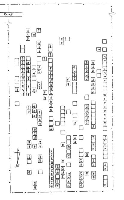
Plot number is a match to the map in the canvass and survey published in "Our People And Where They Rest," James W. Tyner, Maxine Tyner and Alice Tyner Timmons, American Indian Institute, University of Oklahoma, Norman, OK. 1971 Vol. 6, pp. 43-45 (Library of Congress No. QE99-C5-T97), for the cemetery at Section 2, Range 20E, Township 22N in Mayes County. [A public University that received taxpayer dollars for the program/product; thus presumed to be in the public domain] For brevity, often referred to as "Tyner's Plat Map."
Their information (including any diagrams or maps) is given here as a historical reference and is presented "as is." Their book, like many such cemetery listing compilations, may contain errors. As with any genealogy information, this is merely a "source" and should be considered as such. It falls upon the end-user to verify the accuracy. See their map for use as a quick locator tool for graves here. The set of books are available at many Oklahoma libraries. Once freely available for online viewing, the OPAWTR volumes can now be accessed only at a LDS Family History Library, a partner library, or a Family History Center. (LDS) Aug. 2021 update: I am informed that the set is now available on the Family Search website, but you have to be a member, and be signed in, to access it under "Books."~
Their information (including any diagrams or maps) is given here as a historical reference and is presented "as is." Their book, like many such cemetery listing compilations, may contain errors. As with any genealogy information, this is merely a "source" and should be considered as such. It falls upon the end-user to verify the accuracy. See their map for use as a quick locator tool for graves here. The set of books are available at many Oklahoma libraries. Once freely available for online viewing, the OPAWTR volumes can now be accessed only at a LDS Family History Library, a partner library, or a Family History Center. (LDS) Aug. 2021 update: I am informed that the set is now available on the Family Search website, but you have to be a member, and be signed in, to access it under "Books."~
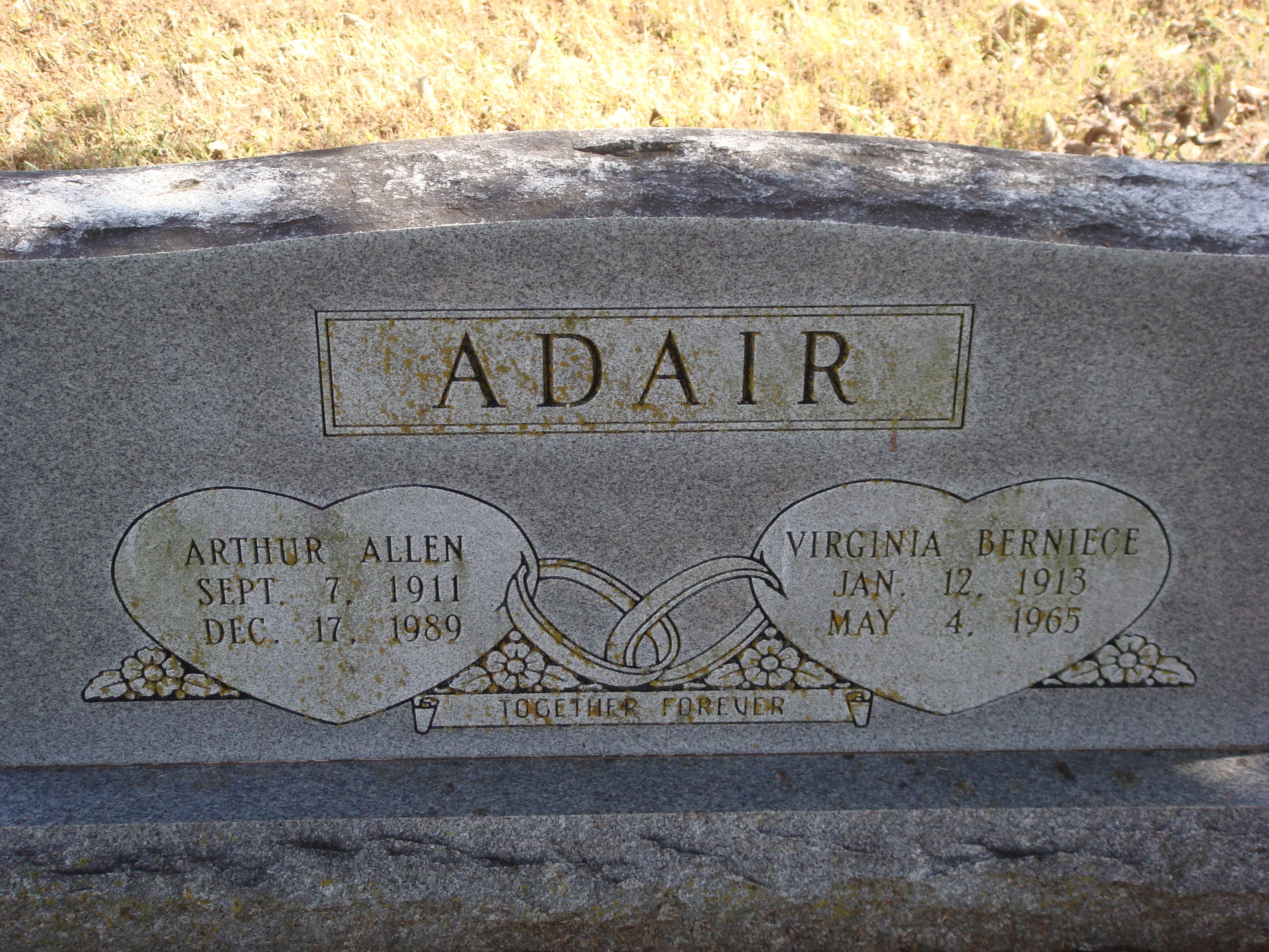
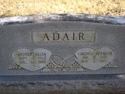
Inscription
Together Forever
Family Members


Sponsored by Ancestry
Advertisement
Explore more
Sponsored by Ancestry
Advertisement