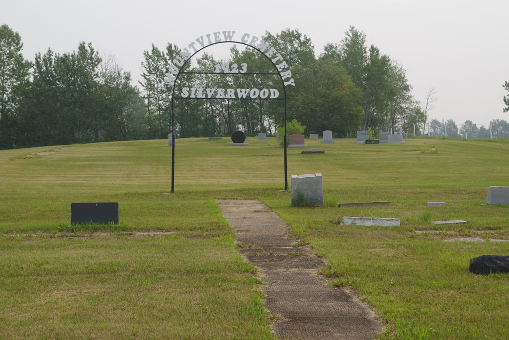
Mountview Cemetery
Also known as Silverwood Cemetery , Sunny Slope Cemetery
Silverwood, Roblin, Russell, Rossburn Census Division, Manitoba, Canada
About
-
Get directions 162950 Silverwood Road
(aka Provincial Road 169AW)
Silverwood, Roblin, Manitoba
R0L 1T0 CanadaCoordinates: 51.40541, -101.42840 - roblinmanitoba.com/p/points-of-interest
- [email protected]
- +1-204-937-8333
-
Office Address
Municipality of Roblin
125-1st Avenue NW
PO Box 998
Roblin, Roblin, Manitoba
R0L 1P0 Canada - Cemetery ID:
-
Additional information
Located 1 mile (1.6 km) south of the former community of Silverwood, MB, on the SE corner of the junction of Silverwood Road (aka Provincial Road 169AW) and Provincial Range Road 163N
There is no network of improved roadways providing vehicular access to the grounds.
The cemetery is managed by a local committee, whose current contact information is available from the staff of the Municipality of Roblin [2024/03].
Members have Contributed
Advertisement
Photos
No additional photos.
Add PhotosThe history of the Sunny Slope and Silverwood districts begins about the turn of the [twentieth] century, or, at any rate, to the time of the arrival of the Canadian Northern Railway in 1903, which name was later changed to Canadian National Railway. The progress achieved has come not easily, but gradually nonetheless, and is often referred to as a period of 'sweat and tears', failure, success, tragedy and happiness. To look eighty years ahead, many have said, "It seems like a long time," but the few who do remain with us and are looking back say, "How quickly the time has gone!" To the early pioneers and those who have gone before us, we owe a tremendous debt for the comforts and pleasures of the life which we presently enjoy.
These two districts of Sunny Slope and Silverwood were in many ways very closely interknit, one with the other. Going back to the time before the railway arrived in 1903, most of these first early pioneers trekked in by any means of transportation available to them at the time. Most of them arrived at Russell, Manitoba by train from either other settlements in Manitoba, or from Ontario, bringing with them whatever few belongings they could manage to arrive here with. They stepped off the train only to continue on to their newly acquired homesteads. Some had a few cattle, oxen or even an odd horse or two, but many continued on their journey on foot.
One family in particular (the Comries) lived in a tent until such time as a two-roomed log shack could be erected. This was home for many years.
Some of the earlies families to settle in the Sunny Slope area were: Webb, McCorquodale, Bailey, Golden, Rolson, McBride, Rodgers, Charbonneau, Dunlop, White, Keay, Thompson, Allen, Cowan, Rule, Addis, Sutherland, Sherson and Black. Donald and Mac Stewart must also be added. These people performed a great service in laying the foundations of the district. In later years the names of Elder, Donaldson, Laliberte, Ferguson, Traub, Doering, Beliski; they also provided any service they could to a fast growing rural community.
The names of Lade, Armstead, Pearson, Nelson, McLean, Heard, Bell, Luxton, Law, Embleton, Rosavere, Kennedy, King, Rae, McCush, Garret, Burgis, Lewis, Byce, Wilkinson, Jesse Thompson, Smith, Irvine, Burnett, Williams, Gerega, Pillen, Redman, Jose, Kirkpatrick, Sangster (two families), Weary, and Maguire.
(Source: Shell River Municipality Century One - 1884-1984, pp 189ff, [1984; Adapted])
~~~~~~~~~~
Dominion Land Survey coordinates: LSD13-13-28-29-W1
In the Municipality of Roblin
~~~~~~~~~~
As noted above, a part of the community's story, and those of its inhabitants, from the early days of European settlement through roughly 2000 is told in the volume "Shell River Municipality Century One - 1884-1984", especially on the cited pages, and in the later related work entitled "Roblin and Rural Districts Family Histories - Volumes I, II, and III".
Free digital versions of the former, Volume III of the latter, and many other Manitoba local history books can be found online in the University of Manitoba Digital Collections. There is also a list of such books organized by district and town name on the Manitoba Historical Society's website on their page entitled "Finding Aid: Manitoba Local History Books".
A list of burials in this cemetery is available from the Manitoba Genealogical Society (reference #nnnn), transcribed by a member or members in NNNN and updated in NNNN. Also available to MGS members is a searchable online database named the "MGS Manitoba Name Index" (or MANI). Some additional information is contained in the 1996 MGS publication "Carved in Stone: Manitoba Cemeteries and Burial Sites" (revised edition, Special Projects Publication, 106 pages).
The history of the Sunny Slope and Silverwood districts begins about the turn of the [twentieth] century, or, at any rate, to the time of the arrival of the Canadian Northern Railway in 1903, which name was later changed to Canadian National Railway. The progress achieved has come not easily, but gradually nonetheless, and is often referred to as a period of 'sweat and tears', failure, success, tragedy and happiness. To look eighty years ahead, many have said, "It seems like a long time," but the few who do remain with us and are looking back say, "How quickly the time has gone!" To the early pioneers and those who have gone before us, we owe a tremendous debt for the comforts and pleasures of the life which we presently enjoy.
These two districts of Sunny Slope and Silverwood were in many ways very closely interknit, one with the other. Going back to the time before the railway arrived in 1903, most of these first early pioneers trekked in by any means of transportation available to them at the time. Most of them arrived at Russell, Manitoba by train from either other settlements in Manitoba, or from Ontario, bringing with them whatever few belongings they could manage to arrive here with. They stepped off the train only to continue on to their newly acquired homesteads. Some had a few cattle, oxen or even an odd horse or two, but many continued on their journey on foot.
One family in particular (the Comries) lived in a tent until such time as a two-roomed log shack could be erected. This was home for many years.
Some of the earlies families to settle in the Sunny Slope area were: Webb, McCorquodale, Bailey, Golden, Rolson, McBride, Rodgers, Charbonneau, Dunlop, White, Keay, Thompson, Allen, Cowan, Rule, Addis, Sutherland, Sherson and Black. Donald and Mac Stewart must also be added. These people performed a great service in laying the foundations of the district. In later years the names of Elder, Donaldson, Laliberte, Ferguson, Traub, Doering, Beliski; they also provided any service they could to a fast growing rural community.
The names of Lade, Armstead, Pearson, Nelson, McLean, Heard, Bell, Luxton, Law, Embleton, Rosavere, Kennedy, King, Rae, McCush, Garret, Burgis, Lewis, Byce, Wilkinson, Jesse Thompson, Smith, Irvine, Burnett, Williams, Gerega, Pillen, Redman, Jose, Kirkpatrick, Sangster (two families), Weary, and Maguire.
(Source: Shell River Municipality Century One - 1884-1984, pp 189ff, [1984; Adapted])
~~~~~~~~~~
Dominion Land Survey coordinates: LSD13-13-28-29-W1
In the Municipality of Roblin
~~~~~~~~~~
As noted above, a part of the community's story, and those of its inhabitants, from the early days of European settlement through roughly 2000 is told in the volume "Shell River Municipality Century One - 1884-1984", especially on the cited pages, and in the later related work entitled "Roblin and Rural Districts Family Histories - Volumes I, II, and III".
Free digital versions of the former, Volume III of the latter, and many other Manitoba local history books can be found online in the University of Manitoba Digital Collections. There is also a list of such books organized by district and town name on the Manitoba Historical Society's website on their page entitled "Finding Aid: Manitoba Local History Books".
A list of burials in this cemetery is available from the Manitoba Genealogical Society (reference #nnnn), transcribed by a member or members in NNNN and updated in NNNN. Also available to MGS members is a searchable online database named the "MGS Manitoba Name Index" (or MANI). Some additional information is contained in the 1996 MGS publication "Carved in Stone: Manitoba Cemeteries and Burial Sites" (revised edition, Special Projects Publication, 106 pages).
Nearby cemeteries

Roblin, Roblin, Russell, Rossburn Census Division, Manitoba, Canada
- Total memorials127
- Percent photographed98%
- Percent with GPS0%
Zelena, Roblin, Russell, Rossburn Census Division, Manitoba, Canada
- Total memorials1
- Percent photographed0%
- Percent with GPS0%

Makaroff, Roblin, Russell, Rossburn Census Division, Manitoba, Canada
- Total memorials212
- Percent photographed94%
- Percent with GPS1%

San Clara, Roblin, Russell, Rossburn Census Division, Manitoba, Canada
- Total memorials43
- Percent photographed100%
- Percent with GPS0%
- Added: 7 Aug 2013
- Find a Grave Cemetery ID: 2507480

Cemetery Photos
This is a carousel with slides. Use Next and Previous buttons to navigate, or jump to a slide with the slide dots. Use Escape keyboard button or the Close button to close the carousel.
Success
Uploading...
Waiting...
Failed
This photo was not uploaded because this cemetery already has 20 photos
This photo was not uploaded because you have already uploaded 5 photos to this cemetery
This photo was not uploaded because you have already uploaded 5 photos to this cemetery
Invalid File Type
Birth and death years unknown.
1 photo picked...
2 photos picked...
Uploading 1 Photo
Uploading 2 Photos
1 Photo Uploaded
2 Photos Uploaded
Size exceeded
Too many photos have been uploaded
"Unsupported file type"
• ##count## of 0 memorials with GPS displayed. Double click on map to view more.No cemeteries found