Donnybrook Cemetery
Also known as Church of Saint Broc Cemetery
Dublin, County Dublin, Ireland
About
-
Get directions Donnybrook Road (at The Crescent)
Dublin, County Dublin T12 AX94 IrelandCoordinates: 53.32124, -6.23569 - www.dublincity.ie/main-menu-services-culture-dublin-city-parks/cemetery-information
- 353 001 222 2222
- Cemetery ID:
Members have Contributed
Advertisement
Photos

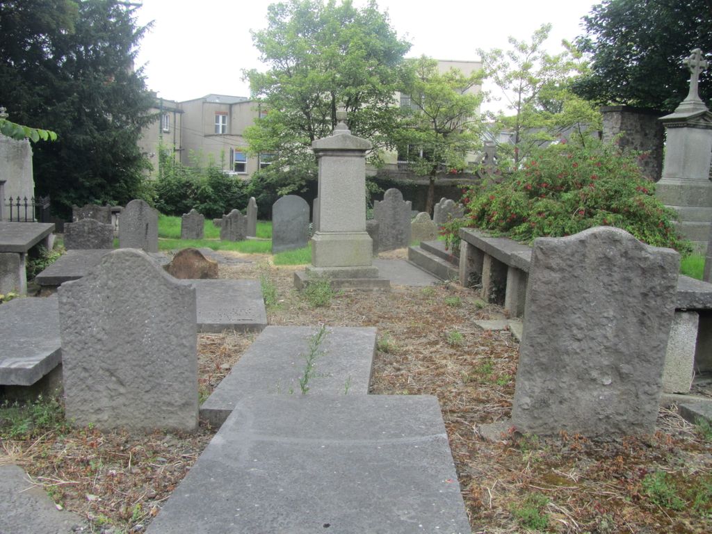
The site was once the location of an old Celtic church founded by Saint Broc which lends its name to Donnybrook (Irish: Domhnach Broc). Sometime between 1181 and 1212, in the same place, the Church of St. Mary was dedicated by the Archbishop of Dublin, Archbishop John Comyn. St Mary's was rebuilt by Archbishop William King in 1720.
By 1827, due to the size of the congregation, a replacement church was built on the corner of Anglesa Road and Simmonscourt Road (on the other bank of the Dodder) and dedicated to St. Mary in 1830. The old church was demolished and the materials were sold off. There is a small wall in the middle of the cemetery that is thought to be the remains of the old church.
The entrance to the cemetery was originally located to the south where the Religious Sisters of Charity (Saint Mary's Convent) are located. Today the entrance is on Donnybrook Road beside the Garda (constabulary) station and is through an archway that was erected by the Dublin Stock Exchange in 1893 in memory of Thomas Chamney Searight.
In 1879 the discovery of the remains of 600 people was made at a mound on Ailesbury Road which dated back to a bloody massacre by the Danes in the 9th to 10th century. The bodies were removed and buried in Donnybrook cemetery.
In 1931 when the street was widened and the entrance was moved back approximately fifteen feet, a mass grave was discovered. The bodies were reburied in the south end of the cemetery.
On 1 May 1976 the Donnybrook Community Development Committee, in addition to restoration works which lasted three years, also compiled a comprehensive list of burials and published a number of historical accounts of the Cemetery. [URL -- www.igp-web.com - /igparchives/ire/dublin/cemeteries/ ]
The cemetery is under the care of Dublin City Council but the gates are locked; however the key can be obtained from the Garda station next door.
Nearby cemeteries

Dublin, County Dublin, Ireland
- Total memorials30
- Percent photographed67%
- Percent with GPS0%

Ballsbridge, County Dublin, Ireland
- Total memorials2
- Percent photographed50%
- Percent with GPS0%


- Added: 20 Jan 2010
- Find a Grave Cemetery ID: 2338748

Cemetery Photos
This is a carousel with slides. Use Next and Previous buttons to navigate, or jump to a slide with the slide dots. Use Escape keyboard button or the Close button to close the carousel.

Success
Uploading...
Waiting...
Failed
This photo was not uploaded because this cemetery already has 20 photos
This photo was not uploaded because you have already uploaded 5 photos to this cemetery
This photo was not uploaded because you have already uploaded 5 photos to this cemetery
Invalid File Type
Birth and death years unknown.
1 photo picked...
2 photos picked...
Uploading 1 Photo
Uploading 2 Photos
1 Photo Uploaded
2 Photos Uploaded
Size exceeded
Too many photos have been uploaded
"Unsupported file type"
• ##count## of 0 memorials with GPS displayed. Double click on map to view more.No cemeteries found