Rue-du-Bacquerot No. 1 Military Cemetery
Laventie, Departement du Pas-de-Calais, Nord-Pas-de-Calais, France
About
-
- Cemetery ID:
Members have Contributed
Advertisement
Photos


Laventie is a village in the Department of the Pas-de-Calais, 6 kilometres south- west of Armentieres and 11 kilometres north of La Bassee. Rue-du-Bacquerot No.1 Military Cemetery is 3 kilometres south of Laventie on the north side of the road to La Couture. Leave Laventie on the D174. At the junction with the D169, which is 2 kilometres from the church, turn right, cross the D173 and continue straight on for another 1.5 kilometres, then turn right into the farmyard. The cemetery is straight in front of you.
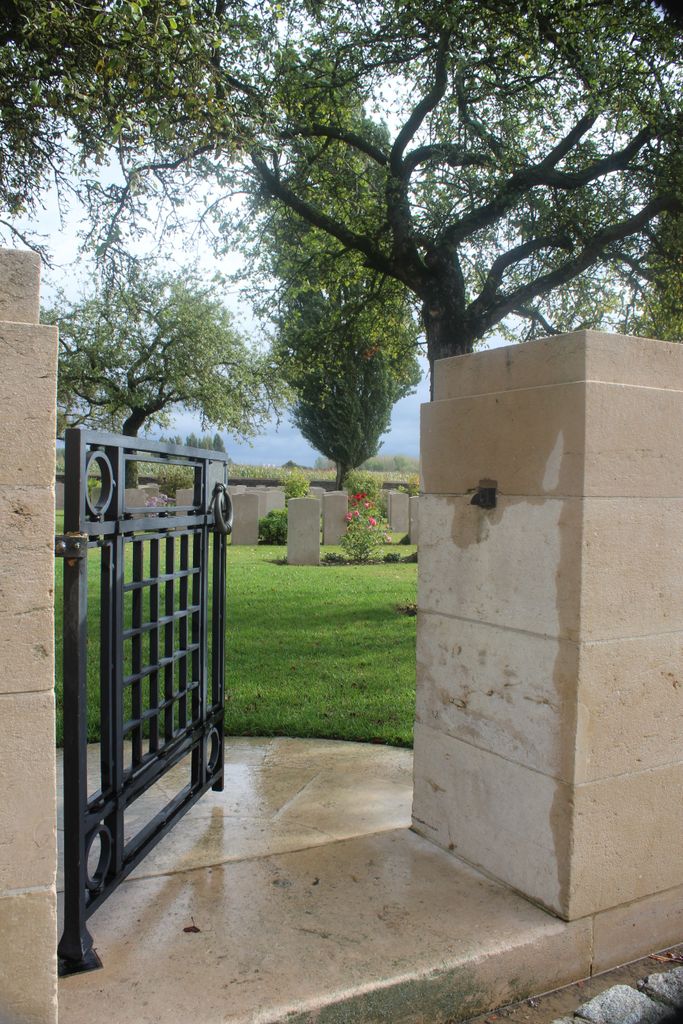
The Rue-du-Bacquerot runs south-east of the village, from the Estaires-La Bassee road towards Fleurbaix, and the position of this road close behind the Allied front trenches during the greater part of the First World War made it the natural line of a number of small Commonwealth cemeteries. One of these, begun by the Indian Corps in November 1914, was the nearest to the Estaires-La Bassee road and became known as Rue-du-Bacquerot No. 1. The cemetery was used until May 1917, and for short periods in 1918, by the units holding the line. After the Armistice the small Indian plots were enlarged when graves were brought in from the battlefields and from smaller burial grounds.
The cemetery contains 637 Commonwealth burials and commemorations of the First World War. 61 of the burials are unidentified and special memorials commemorate 12 casualties. The cemetery also contains seven German graves. The cemetery was designed by Sir Herbert Baker.
Laventie is a village in the Department of the Pas-de-Calais, 6 kilometres south- west of Armentieres and 11 kilometres north of La Bassee. Rue-du-Bacquerot No.1 Military Cemetery is 3 kilometres south of Laventie on the north side of the road to La Couture. Leave Laventie on the D174. At the junction with the D169, which is 2 kilometres from the church, turn right, cross the D173 and continue straight on for another 1.5 kilometres, then turn right into the farmyard. The cemetery is straight in front of you.
The Rue-du-Bacquerot runs south-east of the village, from the Estaires-La Bassee road towards Fleurbaix, and the position of this road close behind the Allied front trenches during the greater part of the First World War made it the natural line of a number of small Commonwealth cemeteries. One of these, begun by the Indian Corps in November 1914, was the nearest to the Estaires-La Bassee road and became known as Rue-du-Bacquerot No. 1. The cemetery was used until May 1917, and for short periods in 1918, by the units holding the line. After the Armistice the small Indian plots were enlarged when graves were brought in from the battlefields and from smaller burial grounds.
The cemetery contains 637 Commonwealth burials and commemorations of the First World War. 61 of the burials are unidentified and special memorials commemorate 12 casualties. The cemetery also contains seven German graves. The cemetery was designed by Sir Herbert Baker.
Nearby cemeteries

Laventie, Departement du Pas-de-Calais, Nord-Pas-de-Calais, France
- Total memorials40
- Percent photographed98%
- Percent with GPS3%

La Gorgue, Departement du Nord, Nord-Pas-de-Calais, France
- Total memorials926
- Percent photographed15%
- Percent with GPS1%

Laventie, Departement du Pas-de-Calais, Nord-Pas-de-Calais, France
- Total memorials465
- Percent photographed24%
- Percent with GPS1%

Laventie, Departement du Pas-de-Calais, Nord-Pas-de-Calais, France
- Total memorials87
- Percent photographed80%
- Added: 19 Dec 2007
- Find a Grave Cemetery ID: 2243223

Cemetery Photos
This is a carousel with slides. Use Next and Previous buttons to navigate, or jump to a slide with the slide dots. Use Escape keyboard button or the Close button to close the carousel.


Success
Uploading...
Waiting...
Failed
This photo was not uploaded because this cemetery already has 20 photos
This photo was not uploaded because you have already uploaded 5 photos to this cemetery
This photo was not uploaded because you have already uploaded 5 photos to this cemetery
Invalid File Type
Birth and death years unknown.
1 photo picked...
2 photos picked...
Uploading 1 Photo
Uploading 2 Photos
1 Photo Uploaded
2 Photos Uploaded
Size exceeded
Too many photos have been uploaded
"Unsupported file type"
• ##count## of 0 memorials with GPS displayed. Double click on map to view more.No cemeteries found