Rounthwaite Cemetery
Rounthwaite, Brandon Census Division, Manitoba, Canada
About
-
Get directions 45500 Provincial Road 344
(aka Provincial Road 104W)
Rounthwaite, Oakland-Wawanesa, Manitoba
R0K 1P0 CanadaCoordinates: 49.67301, -99.82514 - www.oakland-wawanesa.ca/p/cemeteries
- [email protected]
- +1-204-824-2666
-
Office Address
Municipality of Oakland-Wawanesa
106 Fourth Street
PO Box 278
Wawanesa, Oakland-Wawanesa, Manitoba
R0K 2G0 Canada - Cemetery ID:
-
Additional information
Located west of the former location of the community of Rounthwaite, MB, on the east side of Provincial Road 344 (aka Provincial Road 104W), about midway between Tower Road (aka Provincial Range Road 45N) and Provincial Range Road 46N; unusually, the two Range Roads each form a portion of Provincial Road 453, which traverses this part of the province AND the east-west portion of Tower Road (aka Provincial Range Road 45N) to the SE of the cemetery shares both Provincial Road designations (i.e, 344 and 453)
Though there is an allowance for vehicles that is a driveway away from the Provincial Road, it is the oly form of nominal vehicular access to the grounds.
The cemetery is managed by a local committee, whose current contact information is available on the Municipality of Oakland-Wawanesa website [2024/03].
Members have Contributed
Advertisement
Photos
No additional photos.
Add PhotosThe village of Rounthwaite was originally established on SW quarter of section 23, one and a half miles west of the present site, by a small group of Englishmen. It was called Naughton. An Anglican church was built there in 1882 but the post office was three-quarters of a mile south on section 14 with Samuel Rounthwaite as postmaster. Some traces of the building can still be seen.
The railroad came north from Morris about 1890 and connected with Brandon. Soon after, the settlement, including church and post office, was moved to the present site and the name changed to Rounthwaite. However, the name was not officially registered, so Naughton is still the official name on the files at the land titles office.
(Source: Oakland Echoes 1879-1970, p 250 [1970; Adapted])
~~~~~~~~~~
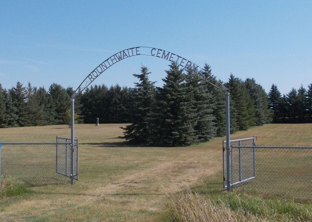
The cemetery is enclosed in a page wire fence.
(Source: Manitoba Genealogical Society [Adapted])
Originally the site of the St. John the Divine Anglican Church, in 1892 the church building was moved to Rounthwaite.
(Source: Manitoba Historical Society [Adapted])
~~~~~~~~~~
Dominion Land Survey coordinates: LSD12-23-08-18-W1
In the Municipality of Oakland-Wawanesa
~~~~~~~~~~
As noted above, a part of the community's story, and those of its inhabitants, from the early days of European settlement through roughly 1970 is told in the volume "Oakland Echoes 1879-1970", especially starting on the cited page. A free digital version of this and many other Manitoba local history books can be found online in the University of Manitoba Digital Collections. There is also a list of such books organized by district and town name on the Manitoba Historical Society's website on their page entitled "Finding Aid: Manitoba Local History Books".
A list of burials in this cemetery is available from the Manitoba Genealogical Society (reference #0116), transcribed by a member or members in 1979. Also available to MGS members is a searchable online database named the "MGS Manitoba Name Index" (or MANI). Some additional information is contained in the 1996 MGS publication "Carved in Stone: Manitoba Cemeteries and Burial Sites" (revised edition, Special Projects Publication, 106 pages).
~~~~~~~~~~
Additionally, many records for Anglican congregations in Manitoba and over part of the territory designated historically as "Rupert's Land" (esp, as bounded on the south by the U.S. border, extending north into the Manitoba Interlake Region past Fairford, with the western boundary reaching into the Pembina Hills and includes Portage la Prairie, eastward the diocese stretches to Sioux Lookout/Atikokan) are now with the Diocese of Rupert's Land and are kept in their offices in Winnipeg, Manitoba, Canada.
The village of Rounthwaite was originally established on SW quarter of section 23, one and a half miles west of the present site, by a small group of Englishmen. It was called Naughton. An Anglican church was built there in 1882 but the post office was three-quarters of a mile south on section 14 with Samuel Rounthwaite as postmaster. Some traces of the building can still be seen.
The railroad came north from Morris about 1890 and connected with Brandon. Soon after, the settlement, including church and post office, was moved to the present site and the name changed to Rounthwaite. However, the name was not officially registered, so Naughton is still the official name on the files at the land titles office.
(Source: Oakland Echoes 1879-1970, p 250 [1970; Adapted])
~~~~~~~~~~
The cemetery is enclosed in a page wire fence.
(Source: Manitoba Genealogical Society [Adapted])
Originally the site of the St. John the Divine Anglican Church, in 1892 the church building was moved to Rounthwaite.
(Source: Manitoba Historical Society [Adapted])
~~~~~~~~~~
Dominion Land Survey coordinates: LSD12-23-08-18-W1
In the Municipality of Oakland-Wawanesa
~~~~~~~~~~
As noted above, a part of the community's story, and those of its inhabitants, from the early days of European settlement through roughly 1970 is told in the volume "Oakland Echoes 1879-1970", especially starting on the cited page. A free digital version of this and many other Manitoba local history books can be found online in the University of Manitoba Digital Collections. There is also a list of such books organized by district and town name on the Manitoba Historical Society's website on their page entitled "Finding Aid: Manitoba Local History Books".
A list of burials in this cemetery is available from the Manitoba Genealogical Society (reference #0116), transcribed by a member or members in 1979. Also available to MGS members is a searchable online database named the "MGS Manitoba Name Index" (or MANI). Some additional information is contained in the 1996 MGS publication "Carved in Stone: Manitoba Cemeteries and Burial Sites" (revised edition, Special Projects Publication, 106 pages).
~~~~~~~~~~
Additionally, many records for Anglican congregations in Manitoba and over part of the territory designated historically as "Rupert's Land" (esp, as bounded on the south by the U.S. border, extending north into the Manitoba Interlake Region past Fairford, with the western boundary reaching into the Pembina Hills and includes Portage la Prairie, eastward the diocese stretches to Sioux Lookout/Atikokan) are now with the Diocese of Rupert's Land and are kept in their offices in Winnipeg, Manitoba, Canada.
Nearby cemeteries

Brandon, Brandon Census Division, Manitoba, Canada
- Total memorials339
- Percent photographed96%
- Percent with GPS0%

Methven, Brandon Census Division, Manitoba, Canada
- Total memorials273
- Percent photographed97%
- Percent with GPS2%

Brandon Hills, Brandon Census Division, Manitoba, Canada
- Total memorials20
- Percent photographed100%
- Percent with GPS95%

Nesbitt, Brandon Census Division, Manitoba, Canada
- Total memorials453
- Percent photographed95%
- Percent with GPS13%
- Added: 6 Sep 2014
- Find a Grave Cemetery ID: 2552932

Cemetery Photos
This is a carousel with slides. Use Next and Previous buttons to navigate, or jump to a slide with the slide dots. Use Escape keyboard button or the Close button to close the carousel.
Success
Uploading...
Waiting...
Failed
This photo was not uploaded because this cemetery already has 20 photos
This photo was not uploaded because you have already uploaded 5 photos to this cemetery
This photo was not uploaded because you have already uploaded 5 photos to this cemetery
Invalid File Type
Birth and death years unknown.
1 photo picked...
2 photos picked...
Uploading 1 Photo
Uploading 2 Photos
1 Photo Uploaded
2 Photos Uploaded
Size exceeded
Too many photos have been uploaded
"Unsupported file type"
• ##count## of 0 memorials with GPS displayed. Double click on map to view more.No cemeteries found