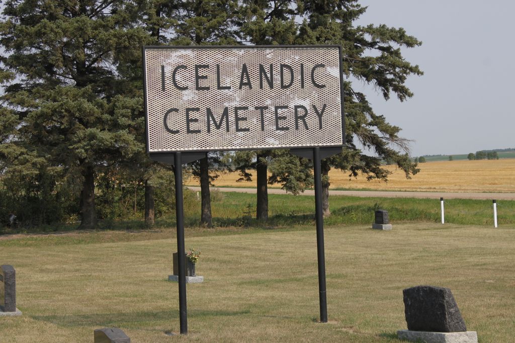
Icelandic Cemetery
Also known as Gudbands Lutheran Cemetery
Brown, Pembina Valley Census Division, Manitoba, Canada
About
-
- www.mhs.mb.ca/docs/sites/icelandiccemetery.shtml
- Cemetery ID:
-
Additional information
The cemetery is located south of the City of Morden, MB, 1 mile west of the former town site of Brown, MB, on the NE corner of the junction of Provincial Road 201 with Provincial Road 33W
Members have Contributed
Advertisement
Photos
No additional photos.
Add PhotosA congregation called "Gudbands" was formed in One-Six on April 8, 1900. by the Rev. Jonas, A. Sigurdson, a Lutheran minister of Akra, ND, USA. The congregation was not able to build a church or hire a resident minister, so the hall was used to hold services conducted by travelling ministers.
In 1900, the first thought of the congregation was to select a plot for a cemetery. The spot chosen was on SE-21-1-6 in the S.E. corner. It was divided into plots and the first person laid to rest there was one of the homesteaders, Arni Arnason in 1902.
In about 1940, a strip of summer fallow on the west and north sides was planted with trees. J. B. Johnson was instrumental in securing the trees while John Hunfiord supervised the planting and the cultivation of these trees.
The Gudbands congregation appointed a committee to care for the cemetery and the repairs to the fence and the mowing of the grass have been done by voluntary labour. The Ladies "Fjolan" has contributed to the cost of repairs to the fence.
(Source: Our 1-6 Heritage - A History of Deer Creek - Lindal - Elk Creek - Diamond, pp 95f [Adapted])
The Evangelical and Reform Church, operational from 1900 through 1962, is located across the road from the cemetery. The Icelandic Lutheran Icelandic Lutheran Congregation (Gudbands) served the Township 1 - Range 6 area.
(Source: Manitoba Genealogical Society [Adapted])
Dominion Land Survey coordinates: LSD01-21-01-06-W1
In the Rural Municipality of Stanley
As noted above, part of the story of the town and its inhabitants from the early days of European settlement through roughly 1976 is told in the volume "Our 1-6 Heritage - A History of Deer Creek - Lindal - Elk Creek - Diamond", especially starting on page 93. A free digital version of this and many other Manitoba local history books can be found online in the University of Manitoba Digital Collections. There is also a list of such books organized by district and town name on the Manitoba Historical Society's website on their page entitled "Finding Aid: Manitoba Local History Books".
A list of burials in this cemetery is available from the Manitoba Genealogical Society, as transcribed by a member or members in 1989 and updated in 1991. Also available to MGS members is a searchable online database named the MGS Manitoba Name Index (or MANI).
A congregation called "Gudbands" was formed in One-Six on April 8, 1900. by the Rev. Jonas, A. Sigurdson, a Lutheran minister of Akra, ND, USA. The congregation was not able to build a church or hire a resident minister, so the hall was used to hold services conducted by travelling ministers.
In 1900, the first thought of the congregation was to select a plot for a cemetery. The spot chosen was on SE-21-1-6 in the S.E. corner. It was divided into plots and the first person laid to rest there was one of the homesteaders, Arni Arnason in 1902.
In about 1940, a strip of summer fallow on the west and north sides was planted with trees. J. B. Johnson was instrumental in securing the trees while John Hunfiord supervised the planting and the cultivation of these trees.
The Gudbands congregation appointed a committee to care for the cemetery and the repairs to the fence and the mowing of the grass have been done by voluntary labour. The Ladies "Fjolan" has contributed to the cost of repairs to the fence.
(Source: Our 1-6 Heritage - A History of Deer Creek - Lindal - Elk Creek - Diamond, pp 95f [Adapted])
The Evangelical and Reform Church, operational from 1900 through 1962, is located across the road from the cemetery. The Icelandic Lutheran Icelandic Lutheran Congregation (Gudbands) served the Township 1 - Range 6 area.
(Source: Manitoba Genealogical Society [Adapted])
Dominion Land Survey coordinates: LSD01-21-01-06-W1
In the Rural Municipality of Stanley
As noted above, part of the story of the town and its inhabitants from the early days of European settlement through roughly 1976 is told in the volume "Our 1-6 Heritage - A History of Deer Creek - Lindal - Elk Creek - Diamond", especially starting on page 93. A free digital version of this and many other Manitoba local history books can be found online in the University of Manitoba Digital Collections. There is also a list of such books organized by district and town name on the Manitoba Historical Society's website on their page entitled "Finding Aid: Manitoba Local History Books".
A list of burials in this cemetery is available from the Manitoba Genealogical Society, as transcribed by a member or members in 1989 and updated in 1991. Also available to MGS members is a searchable online database named the MGS Manitoba Name Index (or MANI).
Nearby cemeteries

Morden, Pembina Valley Census Division, Manitoba, Canada
- Total memorials145
- Percent photographed97%
- Percent with GPS0%
Pembina Valley Census Division, Manitoba, Canada
- Total memorials3
- Percent photographed0%
- Percent with GPS0%
Pembina Valley Census Division, Manitoba, Canada
- Total memorials1
- Percent photographed0%
- Percent with GPS0%
Stanley, Pembina Valley Census Division, Manitoba, Canada
- Total memorials4
- Percent photographed0%
- Percent with GPS0%
- Added: 3 Sep 2017
- Find a Grave Cemetery ID: 2650339

Cemetery Photos
This is a carousel with slides. Use Next and Previous buttons to navigate, or jump to a slide with the slide dots. Use Escape keyboard button or the Close button to close the carousel.
Success
Uploading...
Waiting...
Failed
This photo was not uploaded because this cemetery already has 20 photos
This photo was not uploaded because you have already uploaded 5 photos to this cemetery
This photo was not uploaded because you have already uploaded 5 photos to this cemetery
Invalid File Type
Birth and death years unknown.
1 photo picked...
2 photos picked...
Uploading 1 Photo
Uploading 2 Photos
1 Photo Uploaded
2 Photos Uploaded
Size exceeded
Too many photos have been uploaded
"Unsupported file type"
• ##count## of 0 memorials with GPS displayed. Double click on map to view more.No cemeteries found