Columbia Masonic Cemetery
Columbia, Tuolumne County, California, USA
About
-
Get directions End of School House Street
Columbia, California, USACoordinates: 38.03877, -120.39912 - Cemetery ID:
Members have Contributed
Advertisement
Photos


The three cemeteries have separate gates, are fenced off from each other, and from left to right are:
Columbia Odd Fellows Cemetery
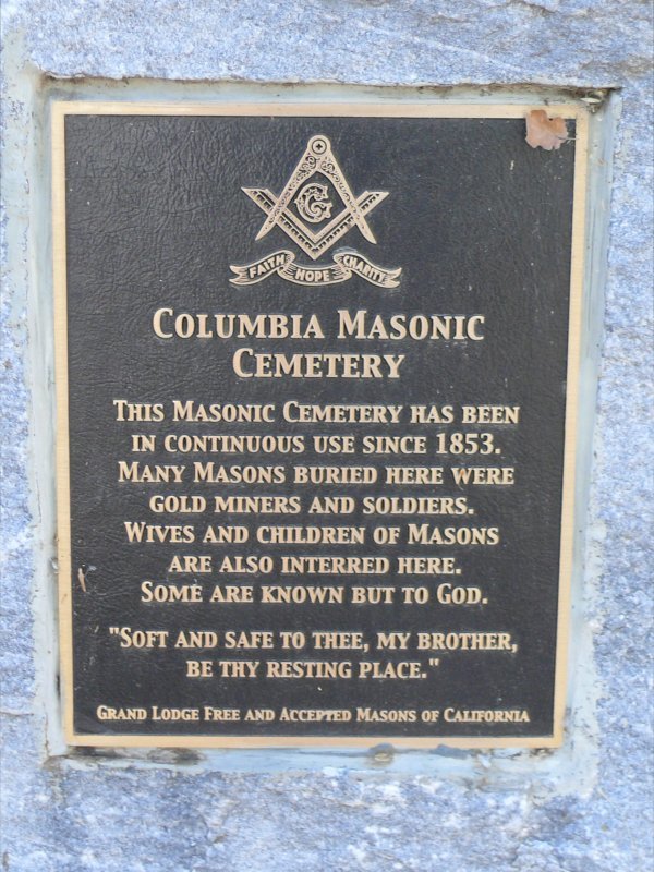
Columbia Masonic Cemetery
Columbia Public Cemetery
Please make sure you have the correct cemetery when adding memorials.
This cemetery is complete and burials are no longer placed here.
The first burial took place June 14th 1852, a Hugh Gillis, and the burial was up on the hill south of State Street and west of Silver Street. When gold was discovered there in January of 1853, the burials were disturbed and desecrated on what was now called Gold Hill. The town Masons appointed a committee to select a new burial ground, and on an October Thursday, they moved John Barclay and John H Smith from Gold Hill to the new burial ground, the present day Masonic cemetery, its perimeter marked by a white fence. The cemetery records have been lost and destroyed several times over the years. The maps and plot numbering system created by Hart R Tambs in 1987 is the basis for recording these burials today.
Columbia Grand Lodge No. 28
The three cemeteries have separate gates, are fenced off from each other, and from left to right are:
Columbia Odd Fellows Cemetery
Columbia Masonic Cemetery
Columbia Public Cemetery
Please make sure you have the correct cemetery when adding memorials.
This cemetery is complete and burials are no longer placed here.
The first burial took place June 14th 1852, a Hugh Gillis, and the burial was up on the hill south of State Street and west of Silver Street. When gold was discovered there in January of 1853, the burials were disturbed and desecrated on what was now called Gold Hill. The town Masons appointed a committee to select a new burial ground, and on an October Thursday, they moved John Barclay and John H Smith from Gold Hill to the new burial ground, the present day Masonic cemetery, its perimeter marked by a white fence. The cemetery records have been lost and destroyed several times over the years. The maps and plot numbering system created by Hart R Tambs in 1987 is the basis for recording these burials today.
Columbia Grand Lodge No. 28
Nearby cemeteries

Columbia, Tuolumne County, California, USA
- Total memorials367
- Percent photographed81%
- Percent with GPS7%

Columbia, Tuolumne County, California, USA
- Total memorials2k+
- Percent photographed65%
- Percent with GPS6%

Columbia, Tuolumne County, California, USA
- Total memorials111
- Percent photographed65%
- Percent with GPS35%

Tuolumne County, California, USA
- Total memorials40
- Percent photographed23%
- Percent with GPS0%
- Added: 16 Aug 2013
- Find a Grave Cemetery ID: 2508651

Cemetery Photos
This is a carousel with slides. Use Next and Previous buttons to navigate, or jump to a slide with the slide dots. Use Escape keyboard button or the Close button to close the carousel.


Success
Uploading...
Waiting...
Failed
This photo was not uploaded because this cemetery already has 20 photos
This photo was not uploaded because you have already uploaded 5 photos to this cemetery
This photo was not uploaded because you have already uploaded 5 photos to this cemetery
Invalid File Type
Birth and death years unknown.
1 photo picked...
2 photos picked...
Uploading 1 Photo
Uploading 2 Photos
1 Photo Uploaded
2 Photos Uploaded
Size exceeded
Too many photos have been uploaded
"Unsupported file type"
• ##count## of 0 memorials with GPS displayed. Double click on map to view more.No cemeteries found