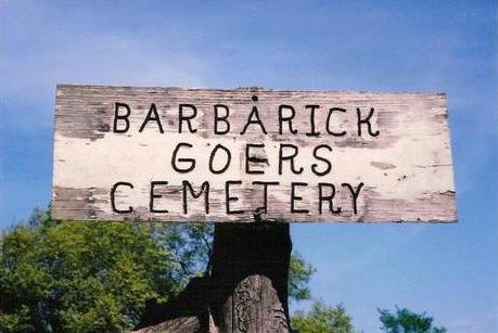
Barbarick Goers Cemetery
Bland, Gasconade County, Missouri, USA
About
-
- Cemetery ID:
Members have Contributed
Advertisement
Photos


Gasconade County Historical Society
Gasconade County, MO (1985)
Location:
Clay Township: Sec. 32, T42N, R6W.
General directions: Head north out of Bland, MO (from Hwy 28), on Highway A. Pass Rehmert Road on right, Jarboe Rd on left, and cemetery is just a bit past Jarboe Rd. alongside Highway A on the right in Section 32. If you reach Boettcher Rd, you've gone too far.
Nearby cemeteries

Gasconade County, Missouri, USA
- Total memorials30
- Percent photographed57%
- Percent with GPS0%
Gasconade County, Missouri, USA
- Total memorials0
- Percent photographed0%
- Percent with GPS0%

Bland, Gasconade County, Missouri, USA
- Total memorials627
- Percent photographed85%
- Percent with GPS2%

Bland, Gasconade County, Missouri, USA
- Total memorials7
- Percent photographed71%
- Percent with GPS29%
- Added: 10 Mar 2004
- Find a Grave Cemetery ID: 1979685

Cemetery Photos
This is a carousel with slides. Use Next and Previous buttons to navigate, or jump to a slide with the slide dots. Use Escape keyboard button or the Close button to close the carousel.


Success
Uploading...
Waiting...
Failed
This photo was not uploaded because this cemetery already has 20 photos
This photo was not uploaded because you have already uploaded 5 photos to this cemetery
This photo was not uploaded because you have already uploaded 5 photos to this cemetery
Invalid File Type
Birth and death years unknown.
1 photo picked...
2 photos picked...
Uploading 1 Photo
Uploading 2 Photos
1 Photo Uploaded
2 Photos Uploaded
Size exceeded
Too many photos have been uploaded
"Unsupported file type"
• ##count## of 0 memorials with GPS displayed. Double click on map to view more.No cemeteries found