New Saint Johns Ebenezer Reformed Cemetery
Also known as Saint John Cemetery , Saint Johns Ebenezer Reformed Cemetery New
Manitowoc County, Wisconsin, USA
About
-
Get directions Center Road and County Road F
Newton, Wisconsin 53063 United StatesCoordinates: 43.97906, -87.74111 - Cemetery ID:
Members have Contributed
Advertisement
Photos


Centerville Township, Manitowoc Co., Wisconsin
ST. JOHNS EBENEZER REFORMED CHURCH CEMETERY - Newer West Section.
The cemetery was transcribed in 2 separate indexes, as if it were 2 different cemetery's. One being the older east section, and the other being the newer west section. This is the newer Western section.
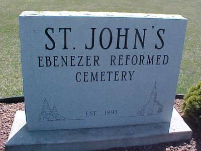
Oldest stone is 1893. The church was torn down long ago.
Location: Take Hwy. 141 (I-43) to Co. Hwy. F, then west on F 3/10 miles to the junction with Center Road. Cemetery is on the SE corner of the junction, south side of the road.
Wisconsin 141 (I-43) to County Highway F, then 3/10 miles west on County Highway F to junction with Center Road
Centerville Township, Manitowoc Co., Wisconsin
ST. JOHNS EBENEZER REFORMED CHURCH CEMETERY - Newer West Section.
The cemetery was transcribed in 2 separate indexes, as if it were 2 different cemetery's. One being the older east section, and the other being the newer west section. This is the newer Western section.
Oldest stone is 1893. The church was torn down long ago.
Location: Take Hwy. 141 (I-43) to Co. Hwy. F, then west on F 3/10 miles to the junction with Center Road. Cemetery is on the SE corner of the junction, south side of the road.
Wisconsin 141 (I-43) to County Highway F, then 3/10 miles west on County Highway F to junction with Center Road
Nearby cemeteries

Manitowoc County, Wisconsin, USA
- Total memorials89
- Percent photographed81%
- Percent with GPS4%

Manitowoc, Manitowoc County, Wisconsin, USA
- Total memorials437
- Percent photographed92%
- Percent with GPS2%

Cleveland, Manitowoc County, Wisconsin, USA
- Total memorials304
- Percent photographed91%
- Percent with GPS5%

Newton, Manitowoc County, Wisconsin, USA
- Total memorials485
- Percent photographed92%
- Percent with GPS3%
- Added: 3 Oct 2011
- Find a Grave Cemetery ID: 2420931

Cemetery Photos
This is a carousel with slides. Use Next and Previous buttons to navigate, or jump to a slide with the slide dots. Use Escape keyboard button or the Close button to close the carousel.


Success
Uploading...
Waiting...
Failed
This photo was not uploaded because this cemetery already has 20 photos
This photo was not uploaded because you have already uploaded 5 photos to this cemetery
This photo was not uploaded because you have already uploaded 5 photos to this cemetery
Invalid File Type
Birth and death years unknown.
1 photo picked...
2 photos picked...
Uploading 1 Photo
Uploading 2 Photos
1 Photo Uploaded
2 Photos Uploaded
Size exceeded
Too many photos have been uploaded
"Unsupported file type"
• ##count## of 0 memorials with GPS displayed. Double click on map to view more.No cemeteries found