Galilee Cemetery
Bowling Green, Warren County, Kentucky, USA – *No GPS coordinates
About
-
- Cemetery ID:
Members have Contributed
- 28 Memorials
- 25% photographed
- No location information available Add Location
Advertisement
Photos


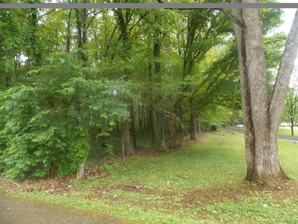
The cemetery is located in a small grove of trees containing one acre for the cemetery and the African American Church that once existed on this one acre. The foundation stone of the church are still visible to the left of the cemetery on this one acre wooded lot. The church & cemetery existed before 1877, based on evidence from the 1877 map of Warren County (https://WWW.loc.gov/item/2012593103/) Based on eye wittness accounts, the church was in existence up to at least the 1930's. The last known burial was that of William Lee Anthony in 1929. The deed of an adjacent land owner shows that one acre of was given to the church by this land owner. The deed indicates that the church was named Galilee.
The 1877 map of Warren county, the 1870 census and the 1880 census indicates that many African American's lived in the small community around the cemetery and church. Some of these families were the Bow, Follin, Loving, Page and Curd. Some of these family members are buried in this cemetery. Additional families known to be buried in the cemetery are the Anthony, Burnam, Burton, Butts, Holder, Kirby, Landers, Robinson, Sears, Smith, Stark Vontress and Wilson families.
This would be a great project for a group or organization to search for grave stones, restore and record the findings.
Directions: From Cumberland Trace Road, take HWY 2629 (Old Scottsville Rd.) south about 3 miles to Roy Thomas Rd, located on te left. Go left and follow 1/4 mile to the Middle bridge Rd. Go right at a fork and another 1/4 mile. The cemetery is on the right at the top of a hill, on the right in the woods and just to the left of the driveway at 2555 Middle Bridge Rd.
NOTE: DO NOT USE THIS DRIVEWAY, AS IT IS ON PRIVATE PROPERTY
This description was written by Kenney Lee, a lifetime resident of this area.
Editors note: Outside of the known engraved stones, the balance of the burials listed were taken from the Kentucky Death Certificates. Some were also found in the Warren County burial Permits Records
Nearby cemeteries

Bowling Green, Warren County, Kentucky, USA
- Total memorials25k+
- Percent photographed83%
- Percent with GPS4%

Bowling Green, Warren County, Kentucky, USA
- Total memorials4k+
- Percent photographed37%
- Percent with GPS2%

Bowling Green, Warren County, Kentucky, USA
- Total memorials3k+
- Percent photographed77%
- Percent with GPS2%

Bowling Green, Warren County, Kentucky, USA
- Total memorials2k+
- Percent photographed90%
- Percent with GPS17%
- Added: 16 May 2014
- Find a Grave Cemetery ID: 2540923

Cemetery Photos
This is a carousel with slides. Use Next and Previous buttons to navigate, or jump to a slide with the slide dots. Use Escape keyboard button or the Close button to close the carousel.


Success
Uploading...
Waiting...
Failed
This photo was not uploaded because this cemetery already has 20 photos
This photo was not uploaded because you have already uploaded 5 photos to this cemetery
This photo was not uploaded because you have already uploaded 5 photos to this cemetery
Invalid File Type
Birth and death years unknown.
1 photo picked...
2 photos picked...
Uploading 1 Photo
Uploading 2 Photos
1 Photo Uploaded
2 Photos Uploaded
Size exceeded
Too many photos have been uploaded
"Unsupported file type"
• ##count## of 0 memorials with GPS displayed. Double click on map to view more.No cemeteries found